
| Reference: | S40093 |
| Author | Nicolas VISSCHER I |
| Year: | 1698 ca. |
| Zone: | Morea |
| Printed: | Amsterdam |
| Measures: | 570 x 465 mm |
| Reference: | S40093 |
| Author | Nicolas VISSCHER I |
| Year: | 1698 ca. |
| Zone: | Morea |
| Printed: | Amsterdam |
| Measures: | 570 x 465 mm |
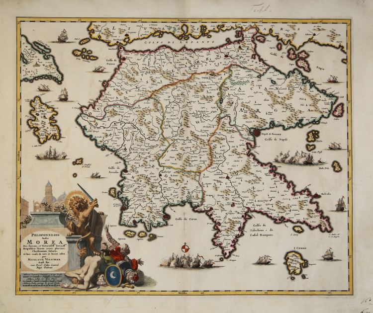
The rare and very detailed map shows the Peloponnese with the islands of Keffalinia, Lefkas, Zakynthos and Kithira in beautiful old colors.
At the end of the 17th Century to the Venetian dominion. The map area is supplemented by an extensive ship staffage and an elaborate figurative cartouche, which shows a part of St. Mark's Square in Venice and a victorious Venetian lion above the defeated Ottomans.
Copperplate, with fine later hand colour, very good condition.
|
Zacharakis n. 2350.
|
Nicolas VISSCHER I (1618 - 1679)
|
For nearly a century the members of the Visscher family were important art dealers and map publishers in Amsterdam. The founder of the business, C. J. Visscher, had premises near to those of Pieter van den Keere and Jodocus Hondius whose pupil he may have been. From about 1620 he designed a number of individual maps, including one of the British Isles, but his first atlas consisted of maps printed from plates bought from van den Keere and issued as they stood with some additions of his own, including historical scenes of battles and sieges for which he had a high reputation. Some maps bear the latinized form of the family name: Piscator. After Visscher's death his son and grandson, both of the same name, issued a considerable number of atlases, constantly revised and brought up to date but most of them lacking an index and with varying contents. The widow of Nicholaes Visscher II carried on the business until it finally passed into the hands of Pieter Schenk.
|
|
Zacharakis n. 2350.
|
Nicolas VISSCHER I (1618 - 1679)
|
For nearly a century the members of the Visscher family were important art dealers and map publishers in Amsterdam. The founder of the business, C. J. Visscher, had premises near to those of Pieter van den Keere and Jodocus Hondius whose pupil he may have been. From about 1620 he designed a number of individual maps, including one of the British Isles, but his first atlas consisted of maps printed from plates bought from van den Keere and issued as they stood with some additions of his own, including historical scenes of battles and sieges for which he had a high reputation. Some maps bear the latinized form of the family name: Piscator. After Visscher's death his son and grandson, both of the same name, issued a considerable number of atlases, constantly revised and brought up to date but most of them lacking an index and with varying contents. The widow of Nicholaes Visscher II carried on the business until it finally passed into the hands of Pieter Schenk.
|