El principio del regno d'Athene Giacomo Filippo FORESTI Code: S14053 Measures: 75 x 55 mm Year: 1490 ca. Printed: Venice Price €130.00 Quick view View Details
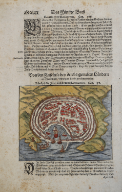
Rhodi Città Giacomo Filippo FORESTI Code: S14054 Measures: 85 x 65 mm Year: 1490 ca. Printed: Venice Price €130.00 Quick view View Details
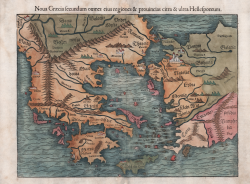
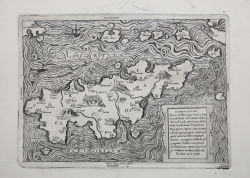
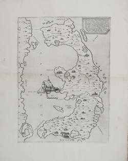
Noua Graecia secundum omnes eius regiones & prouincias & ultra... Sebastian Münster Code: ms6301 Measures: 350 x 260 mm Year: 1540 ca. Printed: Basle Price €525.00 Quick view View Details
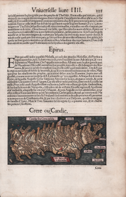
Candia Seu Creta insula Sebastian Münster Code: S48045 Measures: 160 x 800 mm Year: 1550 ca. Printed: Basle Price €180.00 Quick view View Details
Rodi Sebastian Münster Code: s4550 Measures: 155 x 125 mm Year: 1550 ca. Printed: Basle Price €125.00 Quick view View Details
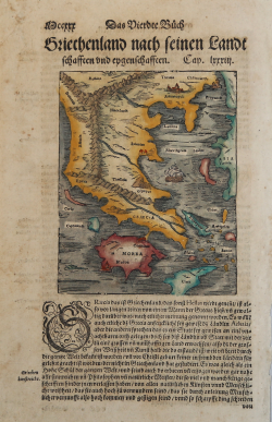
Griecheland nach Seinen Landt Sebastian Münster Code: S17014 Measures: 200 x 325 mm Year: 1550 ca. Printed: Basle Price €130.00 Quick view View Details
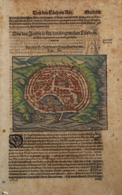
"Rodi" Sebastian Münster Code: s17017 Measures: 155 x 135 mm Year: 1550 ca. Printed: Basle Price €150.00 Quick view View Details
Candido lectori. Haec est illa insignis insula Creta: in medio... Francesco & Michele TRAMEZINO o TRAMEZINI Code: S29752 Measures: 315 x 220 mm Year: 1559 Printed: Rome Price €7,500.00 Quick view View Details
Vogliono alcuni che l'isola di Corfù fosse prima da Sisito latrone... Paolo FORLANI Code: S30341 Measures: 280 x 376 mm Year: 1564 Printed: Venice Price €3,500.00 Quick view View Details
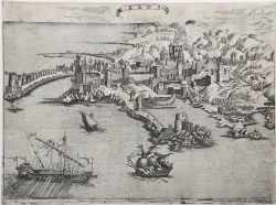
Rodi Anonimo Code: S36738 Measures: 315 x 232 mm Year: 1568 ca. Printed: Venice Price €2,800.00 Quick view View Details
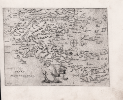
(Morea) Orazio BERTELLI Code: s29842 Measures: 200 x 160 mm Year: 1568 ca. Printed: Venice Price €1,000.00 Quick view View Details
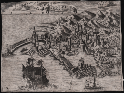
Rodi Citta Donato BERTELLI Code: S30051 Measures: 195 x 144 mm Year: 1568 Printed: Venice Price €600.00 Quick view View Details
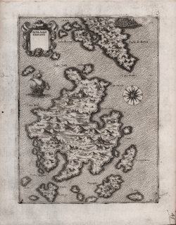
Isola di Cerigo Natale BONIFACIO Code: S22304 Measures: 155 x 210 mm Year: 1568 ca. Printed: Venice Price €1,000.00 Quick view View Details
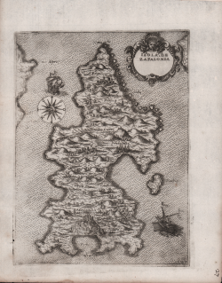
Isola de Zafalonia Natale BONIFACIO Code: S22286 Measures: 150 x 200 mm Year: 1568 ca. Printed: Venice Price €1,000.00 Quick view View Details
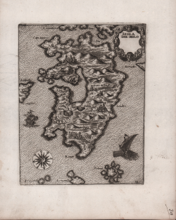
Isola del Milo Natale BONIFACIO Code: S22297 Measures: 135 x 175 mm Year: 1568 ca. Printed: Venice Price €1,000.00 Quick view View Details
Isola de Palmosa Natale BONIFACIO Code: S22294 Measures: 160 x 210 mm Year: 1568 ca. Printed: Venice Price €1,000.00 Quick view View Details
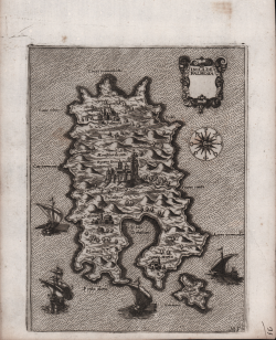
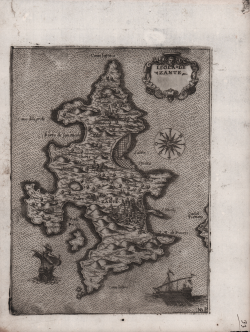
Isola de Zante Natale BONIFACIO Code: S22292 Measures: 155 x 210 mm Year: 1568 ca. Printed: Venice Price €1,000.00 Quick view View Details
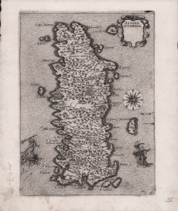
Issola d' Candia Natale BONIFACIO Code: S26304 Measures: 155 x 210 mm Year: 1568 ca. Printed: Venice Price €800.00 Quick view View Details
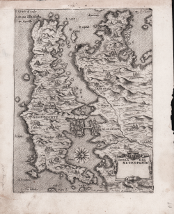
Isola del Negroponte Natale BONIFACIO Code: S26305 Measures: 155 x 210 mm Year: 1568 ca. Printed: Venice Price €800.00 Quick view View Details
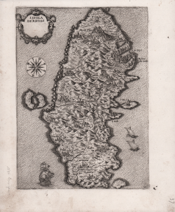
Issola de Rhodi Natale BONIFACIO Code: S26302 Measures: 150 x 210 mm Year: 1568 ca. Printed: Venice Price €800.00 Quick view View Details