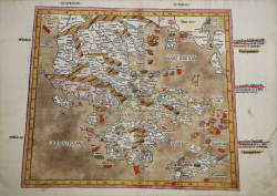
Decima Europe Tabula Donnus Nicolaus GERMANUS Code: S30342 Measures: 550 x 365 mm Year: 1486 Printed: Ulm Price €18,000.00 Quick view View Details
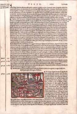
El principio del regno d'Athene Giacomo Filippo FORESTI Code: S14053 Measures: 75 x 55 mm Year: 1490 ca. Printed: Venice Price €130.00 Quick view View Details
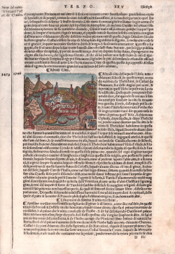
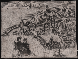
Rhodi Città Giacomo Filippo FORESTI Code: S14054 Measures: 85 x 65 mm Year: 1490 ca. Printed: Venice Price €130.00 Quick view View Details
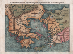
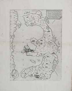
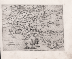
Noua Graecia secundum omnes eius regiones & prouincias & ultra... Sebastian Münster Code: ms6301 Measures: 350 x 260 mm Year: 1540 ca. Printed: Basle Price €525.00 Quick view View Details
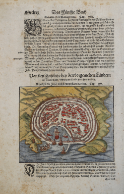
Rodi Sebastian Münster Code: s4550 Measures: 155 x 125 mm Year: 1550 ca. Printed: Basle Price €125.00 Quick view View Details
Vogliono alcuni che l'isola di Corfù fosse prima da Sisito latrone... Paolo FORLANI Code: S30341 Measures: 280 x 376 mm Year: 1564 Printed: Venice Price €3,500.00 Quick view View Details
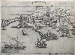
Rodi Anonimo Code: S36738 Measures: 315 x 232 mm Year: 1568 ca. Printed: Venice Price €2,800.00 Quick view View Details
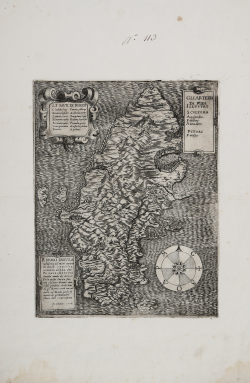
(Morea) Orazio BERTELLI Code: s29842 Measures: 200 x 160 mm Year: 1568 ca. Printed: Venice Price €1,000.00 Quick view View Details
Rodi Citta Donato BERTELLI Code: S30051 Measures: 195 x 144 mm Year: 1568 Printed: Venice Price €600.00 Quick view View Details
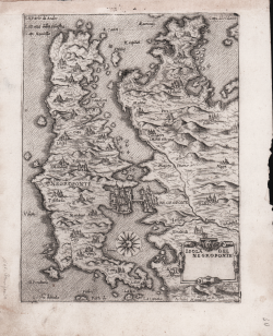
Isola del Negroponte Natale BONIFACIO Code: S26305 Measures: 155 x 210 mm Year: 1568 ca. Printed: Venice Price €800.00 Quick view View Details
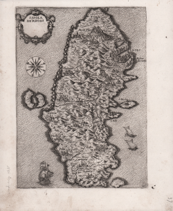
Issola de Rhodi Natale BONIFACIO Code: S26302 Measures: 150 x 210 mm Year: 1568 ca. Printed: Venice Price €800.00 Quick view View Details
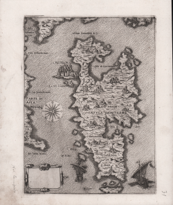
Insula de Metileme Natale BONIFACIO Code: S26296 Measures: 155 x 210 mm Year: 1568 ca. Printed: Venice Price €900.00 Quick view View Details
Isola di Samo Natale BONIFACIO Code: S26301 Measures: 155 x 210 mm Year: 1568 ca. Printed: Venice Price €800.00 Quick view View Details
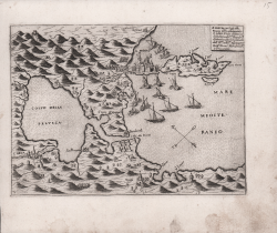
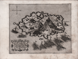
S. Mavra con il golfo della Prevenza posti nella provincia di Achaia… Domenico ZENOI Code: S26280 Measures: 205 x 150 mm Year: 1568 ca. Printed: Venice Price €800.00 Quick view View Details
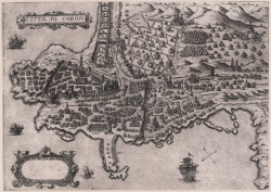
Citta di Coron Donato BERTELLI Code: S39861 Measures: 255 x 184 mm Year: 1569 Printed: Venice Price €900.00 Quick view View Details
Rhodi Insula nobilissima nel Mare Natale BONIFACIO Code: S31617 Measures: 245 x 315 mm Year: 1570 Printed: Venice Price €4,500.00 Quick view View Details
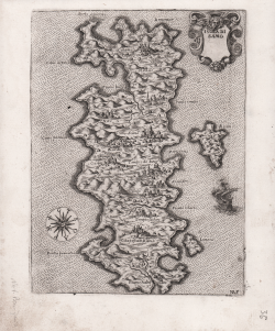
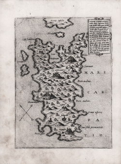
Scarpanto Carpanto antiquamente detto cotal nome derivato facilm.e... Giovanni Francesco CAMOCIO Code: s30292 Measures: 155 x 210 mm Year: 1570 ca. Printed: Venice Price €750.00 Quick view View Details
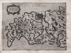
Sancta Maura Scopulum anticham.e detta… Giovanni Francesco CAMOCIO Code: s30286 Measures: 225 x 176 mm Year: 1570 ca. Printed: Venice Price €700.00 Quick view View Details
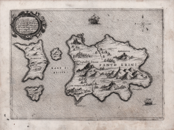
S. Erini et Thiresia insule poste nell'arcipelago sopra il mar di... Giovanni Francesco CAMOCIO Code: s30301 Measures: 230 x 168 mm Year: 1570 ca. Printed: Venice Price €600.00 Quick view View Details
Tine insula et citta antiqua… Giovanni Francesco CAMOCIO Code: s30295 Measures: 207 x 165 mm Year: 1570 ca. Printed: Venice Price €800.00 Quick view View Details