Great Britain and Ireland
Great Britain and Ireland
Sort by:
Showing 1-20 of 95 item(s)
Laurent FRIES
Code:
S42974
Measures:
460 x 320 mm
Year:
1522 ca.
Printed:
Vienne
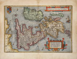
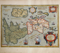
Abraham ORTELIUS
Code:
S34875
Measures:
500 x 345 mm
Year:
1570 ca.
Printed:
Antwerpen
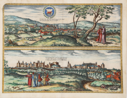
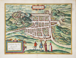
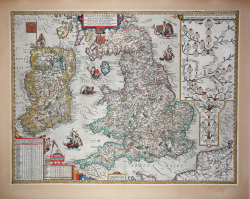
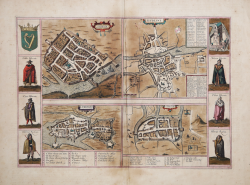
Georg BRAUN & Franz HOGENBERG
Code:
S49238.46
Measures:
490 x 365 mm
Year:
1575 ca.
Printed:
Antwerpen & Cologne
Abraham ORTELIUS - Philip GALLE
Code:
s33926
Measures:
107 x 80 mm
Year:
1577
Printed:
Antwerpen
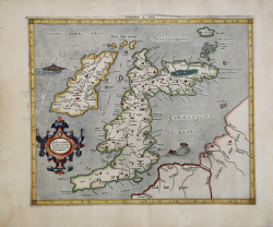
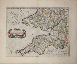
Gerard MERCATOR (Kremer)
Code:
S34892
Measures:
412 x 342 mm
Year:
1578 ca.
Printed:
Cologne
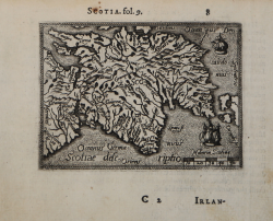
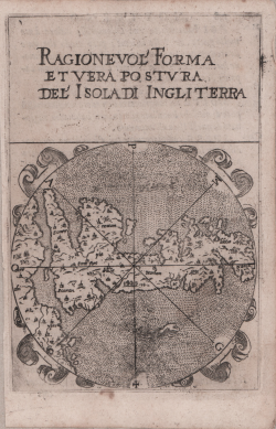
Francesco FERRETTI
Code:
S32129
Measures:
86 x 132 mm
Year:
1579 ca.
Printed:
Ancona
Georg BRAUN & Franz HOGENBERG
Code:
S49238.31
Measures:
453 x 345 mm
Year:
1581 ca.
Printed:
Antwerpen & Cologne
Georg BRAUN & Franz HOGENBERG
Code:
S49238.130
Measures:
420 x 290 mm
Year:
1581 ca.
Printed:
Antwerpen & Cologne
Gerard MERCATOR (Kremer)
Code:
ms2721
Measures:
470 x 370 mm
Year:
1595 ca.
Printed:
Amsterdam
Abraham ORTELIUS
Code:
S46085
Measures:
510 x 370 mm
Year:
1595 ca.
Printed:
Antwerpen
Johannes Baptiste VRIENTS
Code:
S46917
Measures:
580 x 440 mm
Year:
1606 ca.
Printed:
Antwerpen
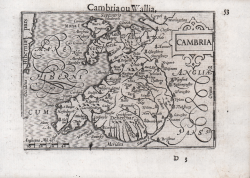
Barent LANGENES
Code:
S50510
Measures:
125 x 85 mm
Year:
1609
Printed:
Frankfurt
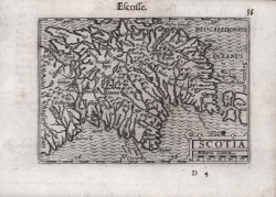
Barent LANGENES
Code:
S50511
Measures:
125 x 85 mm
Year:
1609
Printed:
Frankfurt
Jodocus HONDIUS Jr.
Code:
MS1827.2
Measures:
135 x 95 mm
Year:
1612 ca.
Printed:
Amsterdam
Jodocus HONDIUS Jr.
Code:
MS1827
Measures:
135 x 95 mm
Year:
1616 ca.
Printed:
Amsterdam
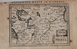
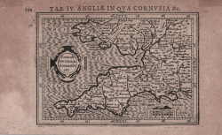
Jodocus HONDIUS Jr.
Code:
MS1834
Measures:
135 x 90 mm
Year:
1616 ca.
Printed:
Amsterdam
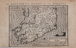
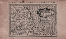
Jodocus HONDIUS Jr.
Code:
MS1833
Measures:
135 x 90 mm
Year:
1616 ca.
Printed:
Amsterdam
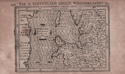
Jodocus HONDIUS Jr.
Code:
ms1836
Measures:
135 x 100 mm
Year:
1616 ca.
Printed:
Amsterdam
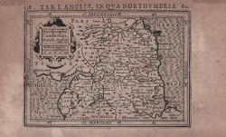
Jodocus HONDIUS Jr.
Code:
MS1837
Measures:
136 x 96 mm
Year:
1616
Printed:
Amsterdam
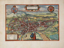
Georg BRAUN & Franz HOGENBERG
Code:
S46058
Measures:
435 x 305 mm
Year:
1618
Printed:
Cologne