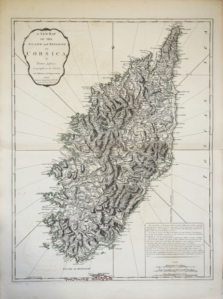
| Reference: | S35603 |
| Author | Thomas JEFFERYS |
| Year: | 1794 |
| Zone: | Corsica |
| Printed: | London |
| Measures: | 505 x 650 mm |
| Reference: | S35603 |
| Author | Thomas JEFFERYS |
| Year: | 1794 |
| Zone: | Corsica |
| Printed: | London |
| Measures: | 505 x 650 mm |
Detailed large format map of Corsica. Includes highly detailed topographical details, including mountains, roads, rivers, bays, and other details. Text note in the lower right corner.
Map taken from "Kitchin's General Atlas, describing the Whole Universe" by Thomas Kitchin: being a complete collection of the most approved maps extant; corrected with the greatest care, and augmented from the last edition of D'Anville and Robert with many improvements by other eminent geographers, engraved on Sixty-Two plates, comprising Thirty Seven maps., Laurie & Whittle, London, 1797.
Etching with original outline colour, very good condition.
Thomas JEFFERYS (ca.1719 – 1771)
|
"Geographer to King George III", was an English cartographer who was the leading map supplier of his day. He engraved and printed maps for government and other official bodies and produced a wide range of commercial maps and atlases, especially of North America. In 1754, Jefferys published a map of Virginia which had been surveyed by Joshua Fry and Peter Jefferson in 1751. The next year he published a Map of the Most Inhabited Part of New England surveyed by John Green, and in 1768 he published A General Topography of North America and the West Indies in association with Robert Sayer. In 1775, after his death, collections of his maps were published by Sayer as The American Atlas and The West-India Atlas.
|