| Reference: | CO-460 |
| Author | Giambattista GHIGI |
| Year: | 1774 |
| Zone: | Central Italy |
| Printed: | Rome |
| Measures: | 470 x 320 mm |
| Reference: | CO-460 |
| Author | Giambattista GHIGI |
| Year: | 1774 |
| Zone: | Central Italy |
| Printed: | Rome |
| Measures: | 470 x 320 mm |
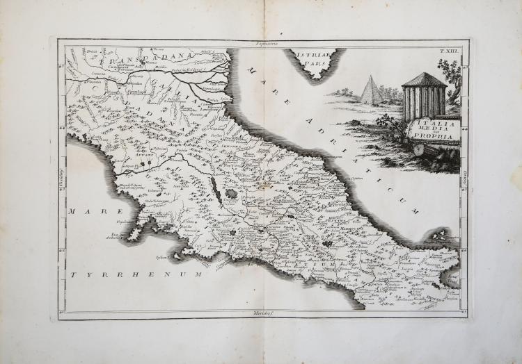
Carta storco geografica dell’Italia centrale tratta da Christophori Cellarii Geographia antiqua in compendium redacta novis praefationibus nunc exornata a Francisco Tirolio et Joanne Baptista Ghisio communi sumptu atque labore amplioribus tabulis aucta et accuratioribus catalogis locupletata, stampato a Roma [Apud Archangelum Casaletti Typographum, et Bibliopolam ad S. Eustachii] nel 1774.
“The relation between history and geography which was so clearly expressed in the views of the encyclopedists, and the renewed education system, lead to a new historical atlas. The last classic atlas published in Italy, which followed the antiquarian fashion, was published in Rome in I 774.65 It was in Latin and was taken from the 1764 London edition of Christoph Cellarius's historical atlas. The authors of the Roman edition were the scholars Giovan Battista Ghigi and Francesco Tirolio. The volume opened with two beautiful frontispieces, one of which was an etching in the peculiar style of Giovambattista Piranesi, then still alive and active. (See Figure 121.) His "Antichita Romane" certainly influenced the designer Giuseppe Barberi, who produced a miscellaneous work from them. The Italian
edition includes some additions to the London one; among the thirty-five maps was a map of the Americas accompanied by an "Additamentum de novo orbe" by Corrado Schwartz. Francesco Jacquier, a professor of mathematics, wrote ten pages on "De origine et progressu Geographiae." The atlas ended with a note by Ruggero Boscovich, describing an ancient anemometer found in the Via Capena
In 1753, ffter the revival of ancient Rome as expressed in this edition of the Cellarius work, historical atlases developed in two different ways. On the one hand, the most common one, geographical atlases included a percentage of historical maps varying from fifteen to twenty percent of the whole work. These were generally modern maps supplemented by historical data” (cfr. V. Valerio, Late Eighteenth- and Early Nineteenth-Century Italian Atlases pp. 269-271.
Bibliografia
G. Marinelli, Saggio di cartografia della regione veneta (Venezia, 1881), no. I 167; M. La Corte, Catalogo di atlanti dei secoli XVI-XVIII (Roma, 1967), p. 134; V. Valerio, Late Eighteenth- and Early Nineteenth-Century Italian Atlases pp. 269-271.
|
Giambattista Ghisi is known for a map of Sicily, published in 1779. With this work, Ghisi changed radically the cartography of Sicily by scientific perspective and graph. The map reported in twelve distinct sections, details on flora, fauna, mineralogy, ichthyology, and more.
|
|
Giambattista Ghisi is known for a map of Sicily, published in 1779. With this work, Ghisi changed radically the cartography of Sicily by scientific perspective and graph. The map reported in twelve distinct sections, details on flora, fauna, mineralogy, ichthyology, and more.
|