
| Reference: | Ms3204 |
| Author | Georg Woolworth COLTON |
| Year: | 1866 ca. |
| Zone: | Cuba |
| Printed: | New York |
| Measures: | 400 x 320 mm |
| Reference: | Ms3204 |
| Author | Georg Woolworth COLTON |
| Year: | 1866 ca. |
| Zone: | Cuba |
| Printed: | New York |
| Measures: | 400 x 320 mm |
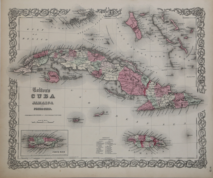
Map taken from Colton's General Atlas, Containing One Hundred And Eighty Steel Plate Maps And Plans, On One Hundred And Nineteen Imperial Folio Sheets, Drawn By G. Woolworth Colton. Letter-Press Descriptions, Geographical, Statistical, And Historical, By Richard Swainson Fisher. New York: G.W. & C.B. Colton, No. 172 William Street. London: Bacon & Co., 48 Paternoster Row. 1866. Entered … 1863, by J.H. Colton … New York. Good conditions.
Shows outstanding detail throughout. Cuba and Jamaica are colored by counties and parishes, with towns, rivers, lakes, mountains and other details shown.
Roads system is shown in Cuba. Cayman Islands is shown in nice detail, as are a portion of the Bahamas.
Georg Woolworth COLTON (1827-1901)
|
Joseph Hutchins Colton, known professionally as J.H. Colton, founded an American mapmaking company which was an international leader in the map publishing industry between 1831 and 1890. In the early 1850s Colton brought his two sons into the business, George Woolworth Colton (1827–1901) and Charles B. Colton (1832–1916).
|