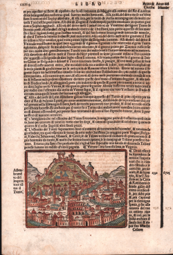
Vienna citta famosissima in Ungaria Giacomo Filippo FORESTI Code: S20685 Measures: 113 x 90 mm Year: 1490 ca. Printed: Venice Price €250.00 Quick view View Details
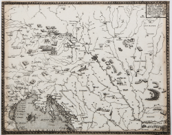
Descritione dell’Austria, et Ongheria, Transilvania, Baviera,... Domenico ZENOI Code: S38501 Measures: 195 x 151 mm Year: 1567 Printed: Venice Price €2,000.00 Quick view View Details
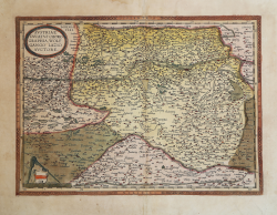
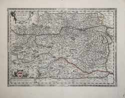
Austriae Ducatus Chorographia, Wolfgango Lazio Auctore Abraham ORTELIUS Code: S4942 Measures: 475 x 350 mm Year: 1570 ca. Printed: Antwerpen Price €375.00 Quick view View Details
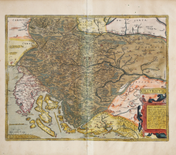
Illyricum Abraham ORTELIUS Code: S46135 Measures: 430 x 530 mm Year: 1572 ca. Printed: Antwerpen Price €600.00 Quick view View Details
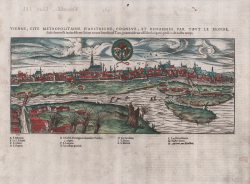
Vienne, Cite metropolitaine d'Austriche, Cogneve, et Renommee per... Francois de BELLEFOREST Code: ms4036 Measures: 360 x 150 mm Year: 1575 ca. Printed: Paris Price €550.00 Quick view View Details
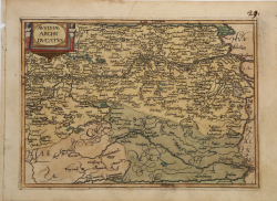
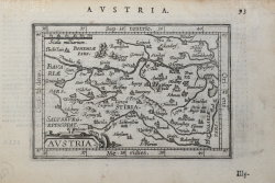
Austriae Archi Ducatus Jan MATAL [METELLUS] Code: s24994 Measures: 195 x 135 mm Year: 1579 ca. Printed: Cologne Price €750.00 Quick view View Details
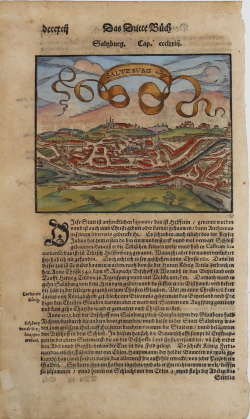
Saltzburg Sebastian Münster Code: S17168 Measures: 200 x 325 mm Year: 1580 ca. Printed: Basle Price €125.00 Quick view View Details
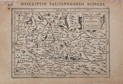
Salisburgensis Iurisdictionis. Abraham ORTELIUS Code: S4939 Measures: 460 x 380 mm Year: 1592 ca. Printed: Antwerpen Price €250.00 Quick view View Details
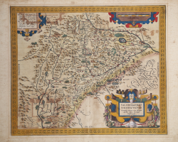
Austria Descrip. per Wolfgangum Lazium Abraham ORTELIUS Code: S40113 Measures: 485 x 350 mm Year: 1592 ca. Printed: Antwerpen Price €325.00 Quick view View Details
Linsum Austriae vulgo Lintz Georg BRAUN & Franz HOGENBERG Code: S49238.177 Measures: 495 x 360 mm Year: 1597 ca. Printed: Antwerpen & Cologne Price €600.00 Quick view View Details New
Austria Jan van Keerbergen Code: ms3888 Measures: 135 x 100 mm Year: 1601 ca. Printed: Frankfurt Price €100.00 Quick view View Details
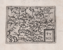
Tyrol Cyprian EICHOVIUS Code: s30607 Measures: 130 x 100 mm Year: 1603 ca. Printed: Cologne Price €750.00 Quick view View Details
Stiria Jodocus HONDIUS Code: S4448 Measures: 200 x 150 mm Year: 1607 ca. Printed: Amsterdam Price €70.00 Quick view View Details
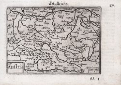
Austria Barent LANGENES Code: S50582 Measures: 125 x 85 mm Year: 1609 Printed: Frankfurt Price €100.00 Quick view View Details
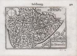
Salisburgensis Dioecesis Barent LANGENES Code: S50583 Measures: 125 x 85 mm Year: 1609 Printed: Frankfurt Price €100.00 Quick view View Details
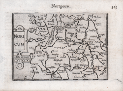
Noricum Barent LANGENES Code: S50580 Measures: 125 x 85 mm Year: 1609 Printed: Frankfurt Price €60.00 Quick view View Details
Saltzburg et Carinthia Jodocus HONDIUS Jr. Code: MS28520 Measures: 135 x 98 mm Year: 1612 ca. Printed: Amsterdam Price €100.00 Quick view View Details
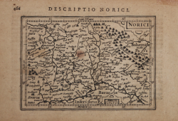
Norici Jodocus HONDIUS Jr. Code: MS2316 Measures: 135 x 95 mm Year: 1616 ca. Printed: Amsterdam Price €50.00 Quick view View Details
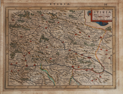
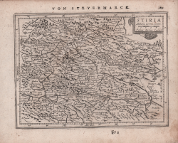
Stiria Johannes JANSSONIUS Code: S48244 Measures: 194 x 146 mm Year: 1628 ca. Printed: Amsterdam Price €80.00 Quick view View Details
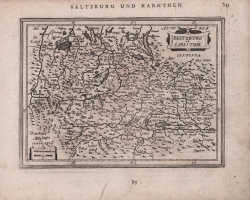
Saltzburg et Carinthie Johannes JANSSONIUS Code: S48245 Measures: 185 x 135 mm Year: 1628 ca. Printed: Amsterdam Price €80.00 Quick view View Details