
| Reference: | CO-284 |
| Author | Jodocus HONDIUS Jr. |
| Year: | 1627 |
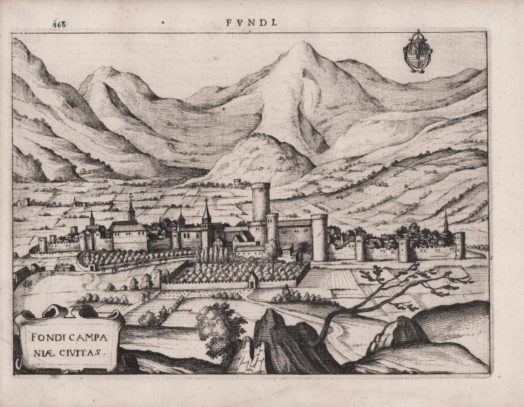
| Zone: | Fondi |
| Printed: | Leyden |
| Measures: | 245 x 180 mm |
| Reference: | CO-284 |
| Author | Jodocus HONDIUS Jr. |
| Year: | 1627 |
| Zone: | Fondi |
| Printed: | Leyden |
| Measures: | 245 x 180 mm |
City plan taken from the famous Theatrum urbium Italicarum, a collection of urban views of the peninsula first published in Venice in 1599. The first edition comprised fifty-nine plates with plans and perspective views by several engravers, accompanied by a Latin description, which were printed separately in Venice (possibly in Francesco Bertelli's workshop), but with the dedication also dated from Padua. The author of the text is unknown, although it has been suggested (Mazzuchelli) that Bertelli himself was the author.
This edition, commonly regarded as the second, was published in Vicenza in 1616 for the types of Domenico Amadio, with the Italian title of "Teatro delle città d'Italia", with the addition of some plates (67 instead of 59) but was preceded by an undated edition consisting of the plates without text.
“L’ultima raccolta di cartografia urbana del XVI secolo, venne stampata da Pietro Bertelli (1571 circa - 1621) nel 1599 Pietro era editore, incisore e tipografo, figlio di Ferrando Bertelli, lavoro a Padova, nella Libreria all’insegna dell’Angelo, a Venezia e a Vicenza. Come incisore, nel 1589 collaboro ad alcune tavole dell’opera Diversarum nationum habitus… composta da 106 stampe, edita in collaborazione con Alciato Alciati. Per le Vite degli imperatori de’ Turchi con le loro effigie intagliate in rame per i tipi di Giorgio Greco, edita a Vicenza nel 1599, Bertelli incise quindici ritratti. Nello stesso anno usci il Theatrum Urbium Italicarum, serie di 59 tavole con vedute e piante accompagnate da descrizione latina, eseguite da più incisori, poi ristampata, accresciuta, anche con il titolo italiano Teatro delle città d’Italia, per i tipi di Domenico Amadio. Alla sua morte, l’attività prosegui con suo figlio Francesco, anch’egli tipografo, incisore e editore. La sua marca tipografica era un angelo in piedi con le ali spiegate, l’avambraccio destro puntato verso l’alto con l’indice al cielo e un giglio nella mano sinistra. Il Teatro delle città d’Italia venne più volte ristampato e implementato da Francesco nel corso del secolo successivo” (cfr. S. Bifolco, Città e Fortezze Principali del Mondo. Le prime raccolte italiane di cartografia urbana e gli isolari del XVI secolo in “Cartografia e topografia italiana del XVI secolo” p. 133).
Copperplate engraving, in good condition.
Jodocus HONDIUS Jr. (Amsterdam 1594 -1629)
|
Jodocus Hondius Jr. was born in 1593, and his earliest signed publication was a map of Scandinavia, issued in 1613. Son of Jodocus Hondius (1563-1612) - engraver, cartographer, printer and publisher – founder of the Hondius typography, that was one of the most important of the time, even thanks to the collection of Mercator’s plates and the pubblication of many charts and atlases. In 1604, Hondius bought the copperplates of Mercator’s Atlas at the auction of Gerard Jr.’s effects. He added another forty maps, including new maps of the Continents and important regional maps of the Americas, before publishing a new edition of the Atlas, in 1606, in competition with Ortelius’ Theatrum. As many of the maps were more up-to-date, the Mercator-Hondius Atlas effectively superseded Ortelius’ Theatrum. On his death in 1612 his widow, Coletta van den Keere continued the business with his two childs; Jodocus Jr. and Hendrick (1597-1651) took over. In June 1621, Jodocus Jr. married Anne Staffmaecker, and moved into a shop on the Dam, where he established his own publishing business. From the period 1621 onwards, Jodocus Jr. published a small number of maps, including several "figured border" maps, including maps of the four continents, the British Isles and Brabant. In 1618 Jodocus Jr. published the important map "Nova Virginiae Tabula", engraved by Dirk Grijp, being the first and most important derivative of John Smith's map of Virginia originally published in 1612. (Burden, America, 193). Other engravers who worked for Hondius are Abraham Goos, Salomon Rogiers, Evert Sijmonsz van Hamersveldt. Very little is known about the cooperation between the Hondius' brothers and their brother-in-law. Aside from the partnership in the continuation of Jodocus Sr's workshop (1612), it seems all three successively started their own businnes. However, from the map of Orange of 1627, it appears that a cooperation certainly extended as far as that year, as the map has a dedication by Jud. et Henr. Hondius to Frederick Henry. According to Peter van the Krogt (cf. Atlantes Neerlandici) Jodocus Hondius Jr. and his younger brother Henricus Hondius where competitors.
|