| Reference: | S9926 |
| Author | Robert BENARD |
| Year: | 1782 |
| Zone: | The World |
| Printed: | Paris |
| Measures: | 345 x 285 mm |
| Reference: | S9926 |
| Author | Robert BENARD |
| Year: | 1782 |
| Zone: | The World |
| Printed: | Paris |
| Measures: | 345 x 285 mm |
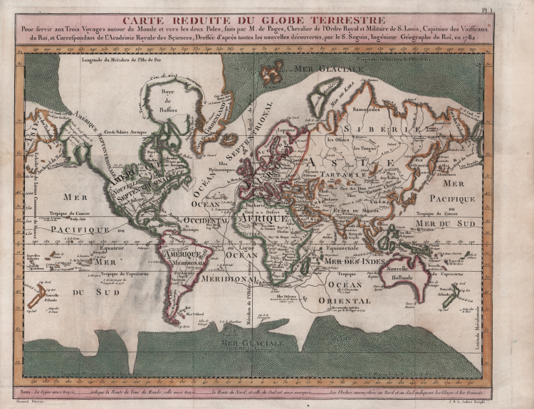
Map of the World on Mercator's projection by Seguit and Robert Benard.
Engraved by J. B. L. Aubert the map is part of the Voyages autour du Monde et vers les deux Poles par Terre et par Mer, by Pierre Marie François de Pages, printed in 1782.
Born of noble family, a French naval officer, Pierre Marie François de Pages, made a five-year voyage around the world, between 1767 and 1771. Subsequently he took part in a two year voyage to the South Pole, between 1773 and 1774. Finally he made a trip to the North Pole in 1776. These voyages were recounted in his publication of 1782.
Etching with fine later hand colour, very good condition.
Robert BENARD(Parigi 1734-1777)
Robert BENARD(Parigi 1734-1777)