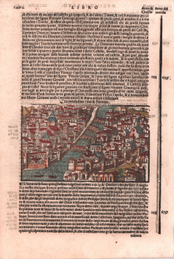
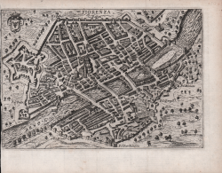
Firenza citta nobilissima in Toscana
Giacomo Filippo FORESTI
Code:
CO-695
Measures:
170 x 255 mm
Year:
1490 ca.
Printed:
Venice
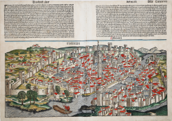
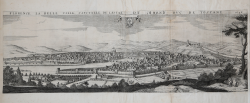
Figur und gelegenheit der Edlen undhochberhümpten Statt Florentz
Sebastian Münster
Code:
S29379
Measures:
330 x 180 mm
Year:
1550 ca.
Printed:
Basle
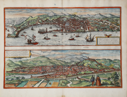
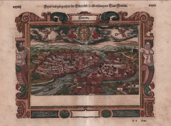
Genua / Florentia
Georg BRAUN & Franz HOGENBERG
Code:
S49238.23
Measures:
480 x 330 mm
Year:
1572 ca.
Printed:
Antwerpen & Cologne
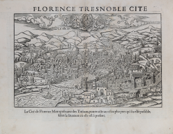
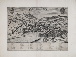
Florence Tresnoble Cite
Francois de BELLEFOREST
Code:
S47352
Measures:
435 x 340 mm
Year:
1575
Printed:
Paris
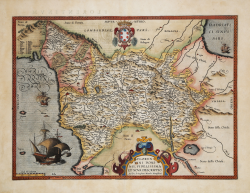
Florentini Dominii, Fidelissima et Nova Descriptio
Abraham ORTELIUS
Code:
S32659
Measures:
470 x 345 mm
Year:
1595 ca.
Printed:
Antwerpen

FLORENCE LA BELLE VILLE CAPITALLE DE LESTAT DU GRAND DUC DE...
Jean BOISSEAU
Code:
s25109
Measures:
730 x 250 mm
Year:
1646
Printed:
Paris
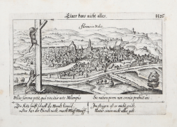
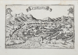
Florens in Italia
Daniel MEISNER
Code:
MS7750
Measures:
150 x 100 mm
Year:
1678 ca.
Printed:
Nurnberg
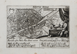
Auritus Midas Florentia
Daniel MEISNER
Code:
s23050
Measures:
150 x 100 mm
Year:
1678 ca.
Printed:
Nurnberg
Prospettiva della Bellissima Citta di Fiorenza, Metropoli del Gran...
Giuseppe LONGHI
Code:
S32411
Measures:
810 x 320 mm
Year:
1680 ca.
Printed:
Bologna
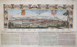
Florence, Capitale de la Toscane
Pieter VANDER AA
Code:
S46696
Measures:
405 x 235 mm
Year:
1713 ca.
Printed:
Leyden
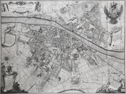
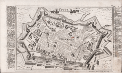
Pianta della città di Firenze nelle sue vere misure colla...
Ferdinando Ruggieri
Code:
S46194
Measures:
675 x 505 mm
Year:
1755
Printed:
Florence
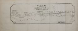
Viaggio da Firenze a Roma
Carlo BARBIERI
Code:
CO-430
Measures:
400 x 125 mm
Year:
1771 ca.
Printed:
Bologna
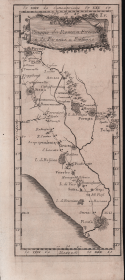
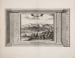
Viaggio da Roma a Firenze e da Firenze a Foligno
Francesco TIROLI
Code:
CO-064
Measures:
115 x 270 mm
Year:
1775
Printed:
Rome