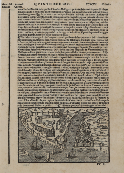
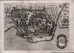
Costantinopoli presa & saccheggiata da Turchi Giacomo Filippo FORESTI Code: S20738 Measures: 145 x 90 mm Year: 1490 ca. Printed: Venice Price €150.00 Quick view View Details
Città de Costantinopoli Giacomo Filippo FORESTI Code: S20737 Measures: 90 x 65 mm Year: 1490 ca. Printed: Venice Price €100.00 Quick view View Details
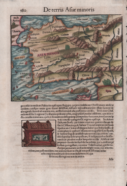
De Terris Asiae Minoris Sebastian Münster Code: MS6337 Measures: 205 x 300 mm Year: 1550 ca. Printed: Basle Price €180.00 Quick view View Details
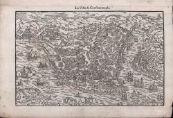
La Ville de Costantinople Guillaume GUEROULT Code: s22249 Measures: 255 x 160 mm Year: 1553 ca. Printed: Lyon Price €1,100.00 Quick view View Details
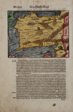
Asia Minor Sebastian Münster Code: AS99 Measures: 175 x 135 mm Year: 1560 ca. Printed: Basle Price €180.00 Quick view View Details
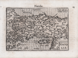
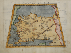
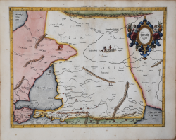
Tabvla Asiae I Girolamo RUSCELLI Code: MS1716 Measures: 260 x 200 mm Year: 1561 ca. Printed: Venice Price €200.00 Quick view View Details
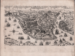
COSTANTINOPOLI Claudio DUCHET (Duchetti) Code: S35103 Measures: 443 x 300 mm Year: 1570 ca. Printed: Rome Price €3,000.00 Quick view View Details
Costantinopoli Balthasar Jenichen Code: S39306 Measures: 365 x 245 mm Year: 1570 ca. Printed: Nurnberg Price €14,500.00 Quick view View Details
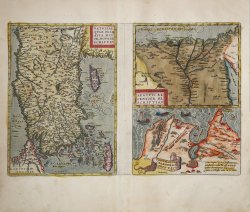
Natoliae quae olim Asia Minor Nova Descriptio/Aegypti Recentior... Abraham ORTELIUS Code: S46128 Measures: 494 x 322 mm Year: 1570 ca. Printed: Antwerpen Price €480.00 Quick view View Details
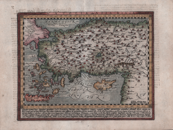
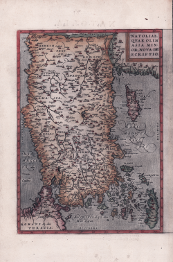
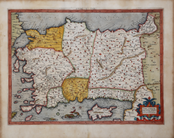
Natoliae quae olim Asia Minor, Nova Descriptio Abraham ORTELIUS Code: S40124 Measures: 245 x 320 mm Year: 1570 Printed: Antwerpen Price €225.00 Quick view View Details
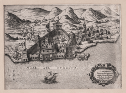
Gallipoli Citta posta sopra il Mare nel Stretto di Costantinopoli… Giovanni Francesco CAMOCIO Code: S30302 Measures: 225 x 165 mm Year: 1571 Printed: Venice Price €400.00 Quick view View Details
Dardanelo Fortezza dala parte dela Gretia posta nella bocha dello... Giovanni Francesco CAMOCIO Code: S42892 Measures: 220 x 165 mm Year: 1571 ca. Printed: Venice Price €300.00 Quick view View Details
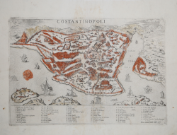
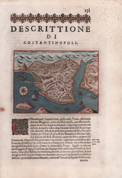
Descrittione di Costantinopoli Tommaso PORCACCHI Code: MS5822 Measures: 145 x 110 mm Year: 1572 ca. Printed: Venice Price €250.00 Quick view View Details
Asiae I Tab. Gerard MERCATOR (Kremer) Code: S10138 Measures: 470 x 350 mm Year: 1578 ca. Printed: Amsterdam Price €450.00 Quick view View Details
Asiae II Tab. Gerard MERCATOR (Kremer) Code: S10139 Measures: 470 x 355 mm Year: 1578 ca. Printed: Amsterdam Price €400.00 Quick view View Details
[Costantinopoli] Giuseppe ROSACCIO Code: S26290 Measures: 180 x 100 mm Year: 1597 ca. Printed: Venice Price €500.00 Quick view View Details
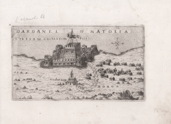
Dardanel d'natolia/ Stretto de Costantinopoli Giuseppe ROSACCIO Code: S26289 Measures: 175 x 100 mm Year: 1598 Printed: Venice Price €300.00 Quick view View Details
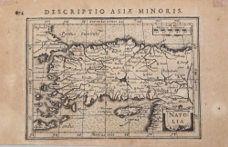
Natolia olim Asia Minor Mattheus QUAD Code: S36134 Measures: 282 x 225 mm Year: 1600 Printed: Cologne Price €450.00 Quick view View Details
Natolia Barent LANGENES Code: S50623 Measures: 125 x 85 mm Year: 1609 Price €150.00 Quick view View Details
Natolia Jodocus HONDIUS Jr. Code: ms1874 Measures: 135 x 100 mm Year: 1616 ca. Printed: Amsterdam Price €130.00 Quick view View Details
![[Costantinopoli]](https://www.antiquarius.it/35334-home_default/-costantinopoli-.jpg)