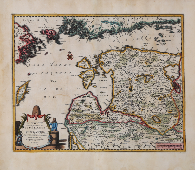
| Reference: | MS6449 |
| Author | Pieter VANDER AA |
| Year: | 1713 ca. |
| Zone: | Estonia, Latvia |
| Printed: | Leyden |
| Measures: | 365 x 295 mm |
| Reference: | MS6449 |
| Author | Pieter VANDER AA |
| Year: | 1713 ca. |
| Zone: | Estonia, Latvia |
| Printed: | Leyden |
| Measures: | 365 x 295 mm |
Detailed map of the Estonia and Latvia on the Baltic Sea, with the contiguous coastline of Finland above, published by Van der Aa in Leiden. The coast of Finland includes Helsinki.
From: Nouvel Atlas, très exact et fort commode pour toutes sortes de personnes, Contenant Les Principales cartes géographiques. Leiden, P. Van der Aa, n.d. (1713).
Pieter van der Aa (1659-1733) was a Dutch mapmaker and publisher who printed pirated editions of foreign bestsellers and illustrated books, but is best known for his voluminous output of maps and atlases. Van der Aa was born to a German stonecutter from Holstein. He was already in 1682 owner of a bookshop and auction house. After 1700, van der Aa increasingly specialised in books on geography and travel. He published composite atlases, a series of geographical descriptions of European countries, and some very spectacular works. He took over many copperplates and prints from other publishers such as Carel Allard and Frederik De Wit. The composite atlases that appeared from his workshop contain a curious mixture of his own material, copies of maps from other publishers, and reprints made from old copper plates, now with his own imprint. The Galérie agréable du monde, was completed in 1729, and comprised 66 parts, bound in 27 volumes.
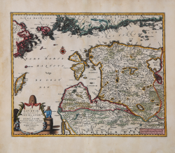
Copperplate with fine later hand colour, very good condition.
Bibliografia
Van der Krogt A, 43:42; Dutch Maps of Russia & Poland, 21:020; Koeman, Aa7 (18).
Pieter VANDER AA (1659 - 1733)
|
Records show that van der Aa, born in Leyden in 1659, made an early start in life by being apprenticed to a bookseller at the age of nine and starting on his own in business as a book publisher by the time he was twenty-three.
During the following fifty years he published an enormous amount of material, including atlases and illustrated works in every shape and size, two of them consisting of no less than 27 and 28 volumes containing over 3,000 maps and plates.
Most of his maps were not of the first quality and were certainly not original, but they are often very decorative and are collected on that account.
|