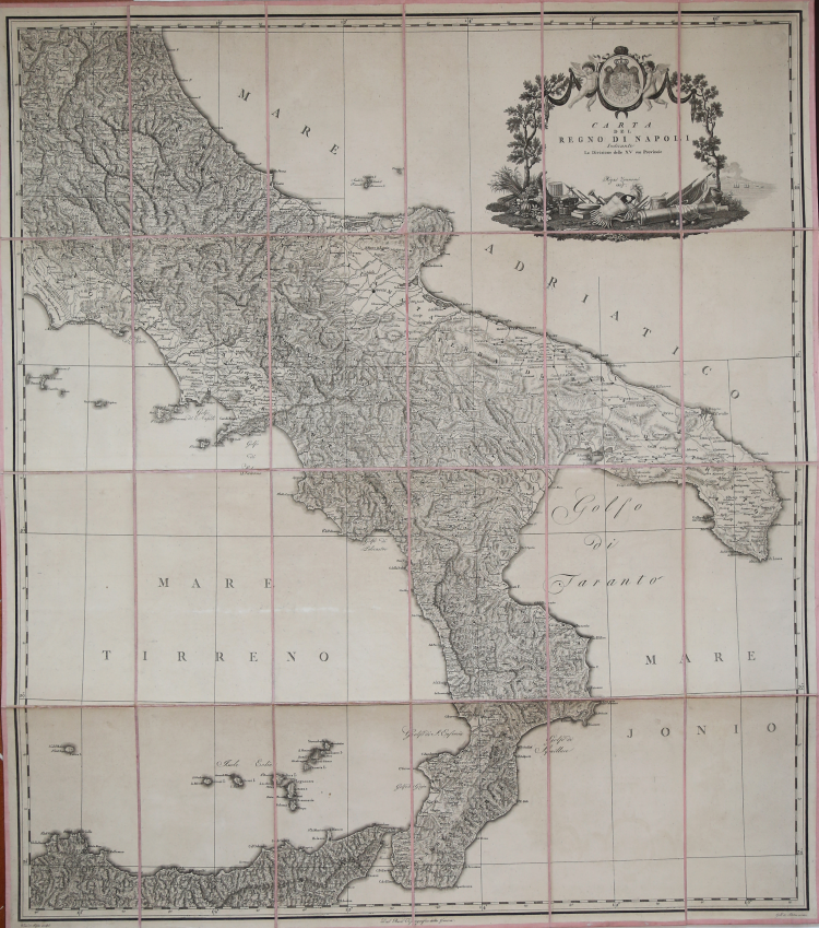

| Reference: | IT36114 |
| Author | Giovanni Antonio RIZZI ZANNONI |
| Year: | 1807 |
| Zone: | Southern Italy |
| Printed: | Naples |
| Measures: | 710 x 805 mm |
| Reference: | IT36114 |
| Author | Giovanni Antonio RIZZI ZANNONI |
| Year: | 1807 |
| Zone: | Southern Italy |
| Printed: | Naples |
| Measures: | 710 x 805 mm |
Rizzi Zannoni is considered the most important Italian cartographer since Giovanni Antonio Magini. He worked in France, Padua and above all in Naples (1781/1814), where he was so appointed “geographer of the King” by the Borbone, a role he kept also after the French arrival. In 1807 Giuseppe Bonaparte appointed him head of the Deposito topografico; in 1812, under Gioacchino Murat, he printed the last sheet, of 31, which were part of his geographic atlas, starter in 1788. The woks he realized in Naples along thirty years made him the greatest modern cartographer in Italy and one of the most influential in Europe. A very decorative cartouche. Copper engraving, laid on canvas and kept in a box, in excelent condition. Engraved by Vincenzo Aloia.
Giovanni Antonio RIZZI ZANNONI (1736 - 1814)
|
Rizzi Zannoni was a noted astronomer, surveyor and mathematician of great versatility. His achieevements included a large scale map of Poland, appointmenys as Geographer to the Venetian Republic and as Hydrographer to the Dèpot de Marine in Paris. The maps in his various atlases were beatifully engraved, showing minute details and embellished with elaborate cartouches. His earlier atlases were published in Paris but his later works first appeared in Naples.
Principali pubblicazioni:
1762 Atlas géographique
1763 Atlas Géographique et militaire
1765 Le petit Neptune Francois
1772 Carte Générale de la Pologne
1792 Atlante Maritimo delle due Sicilie
1795 Nuova carta della Lombardia
|