| Reference: | CO-541 |
| Author | Istituito Geografico WEIMAR |
| Year: | 1805 ca. |
| Zone: | Southern Italy |
| Printed: | Weimar |
| Measures: | 120 x 175 mm |
| Reference: | CO-541 |
| Author | Istituito Geografico WEIMAR |
| Year: | 1805 ca. |
| Zone: | Southern Italy |
| Printed: | Weimar |
| Measures: | 120 x 175 mm |
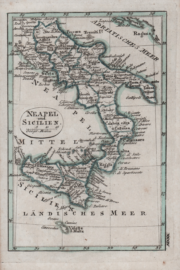
Piccola carta geografica del Regno di Napoli con la Sicilia, stampata probabilmente a Weimar all’inizio del XIX secolo.
Acquaforte, coloritura coeva, in ottimo stato di conservazione. Rara.
|
Founded by friecrich Justin Bertuch in 1804 in Weimar, to engrave, print and publish both domestic and foreign geographical and cartographical publications including shool atlases, historical atlases, regional, world and special atlases. The Institut took over the publication of many of the maps first created and published by the Landes-Industrie Comptoir. Many important mapmakers worked for the company including: Gussefeld, August and Adolf Stieler, Heirich Hiepert ecc.
|
|
Founded by friecrich Justin Bertuch in 1804 in Weimar, to engrave, print and publish both domestic and foreign geographical and cartographical publications including shool atlases, historical atlases, regional, world and special atlases. The Institut took over the publication of many of the maps first created and published by the Landes-Industrie Comptoir. Many important mapmakers worked for the company including: Gussefeld, August and Adolf Stieler, Heirich Hiepert ecc.
|