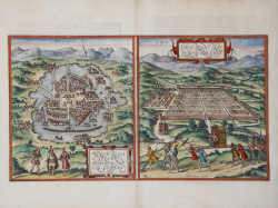
Mexico, Regia et Celebris Hispaniae Novae Civitas / Cusco Regni...
Georg BRAUN & Franz HOGENBERG
Code:
S49238.10
Measures:
480 x 275 mm
Year:
1572 ca.
Printed:
Antwerpen & Cologne
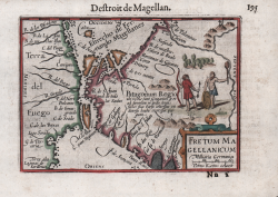
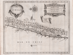
Fretum Magellanicum
Barent LANGENES
Code:
S50673
Measures:
125 x 90 mm
Year:
1598 ca.
Printed:
Amsterdam
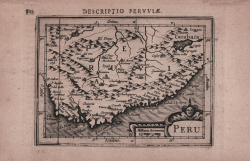
America Meridionalis
Jodocus HONDIUS Jr.
Code:
ms2408
Measures:
135 x 100 mm
Year:
1616 ca.
Printed:
Amsterdam
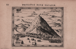
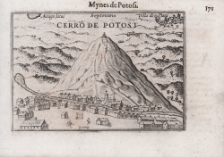
Cerro de Potosi
Jodocus HONDIUS Jr.
Code:
MS2410
Measures:
130 x 110 mm
Year:
1616 ca.
Printed:
Amsterdam
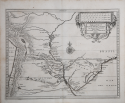
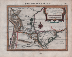
Paraguay ò Prov. de Rio de La Plata: cum adiacentibus Provinciis
Johannes de Laet
Code:
S44865
Measures:
360 x 285 mm
Year:
1625 ca.
Printed:
Leyden

Provinciae Sitae ad Fretum Magallanis itemque Fretum le Maire
Johannes de Laet
Code:
S44864
Measures:
360 x 285 mm
Year:
1625 ca.
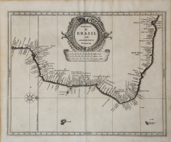
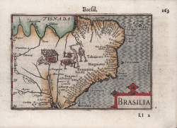
Provincia de Brasil cum Adiacentibus Provinciis
Johannes de Laet
Code:
S44866
Measures:
360 x 285 mm
Year:
1625 ca.
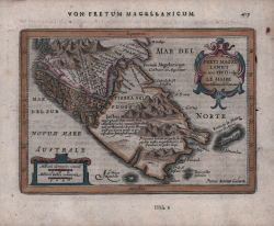
Freti Magellanici ac novi Freti vulgo Le Maire exactissima delineatio
Johannes JANSSONIUS
Code:
S48210
Measures:
190 x 135 mm
Year:
1628 ca.
Printed:
Amsterdam
Paraguay, ò Prov de Rio de La Plata...
Johannes JANSSONIUS
Code:
S48209
Measures:
195 x 145 mm
Year:
1628 ca.
Printed:
Amsterdam
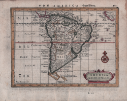
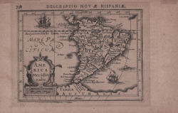
America Meridionalis
Johannes JANSSONIUS
Code:
S48206
Measures:
195 x 145 mm
Year:
1628 ca.
Printed:
Amsterdam
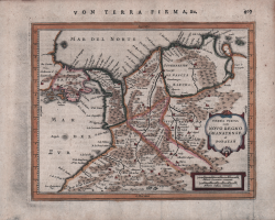
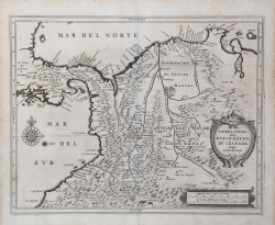
Terra Firma cum Novo Regno Granatense et Popoyan
Johannes JANSSONIUS
Code:
S48207
Measures:
190 x 150 mm
Year:
1628 ca.
Printed:
Amsterdam

Venezuela, cum parte Australi Novae Andalusiae
Johannes JANSSONIUS
Code:
s35019
Measures:
496 x 380 mm
Year:
1630 ca.
Printed:
Amsterdam
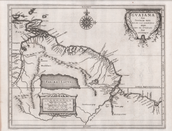
Guaiana sive Provinciae intra Rio de las Amazonas
Johannes de Laet
Code:
S44867
Measures:
360 x 285 mm
Year:
1630 ca.
Printed:
Leyden

Venezuela atque Occidentalis Pars Novae Andalusiae
Johannes de Laet
Code:
S44868
Measures:
360 x 285 mm
Year:
1630 ca.
Printed:
Amsterdam
Tierra Firma item Nuevo Reyno de Granada atque Popayan
Johannes de Laet
Code:
S44861
Measures:
360 x 285 mm
Year:
1630 ca.
Printed:
Amsterdam