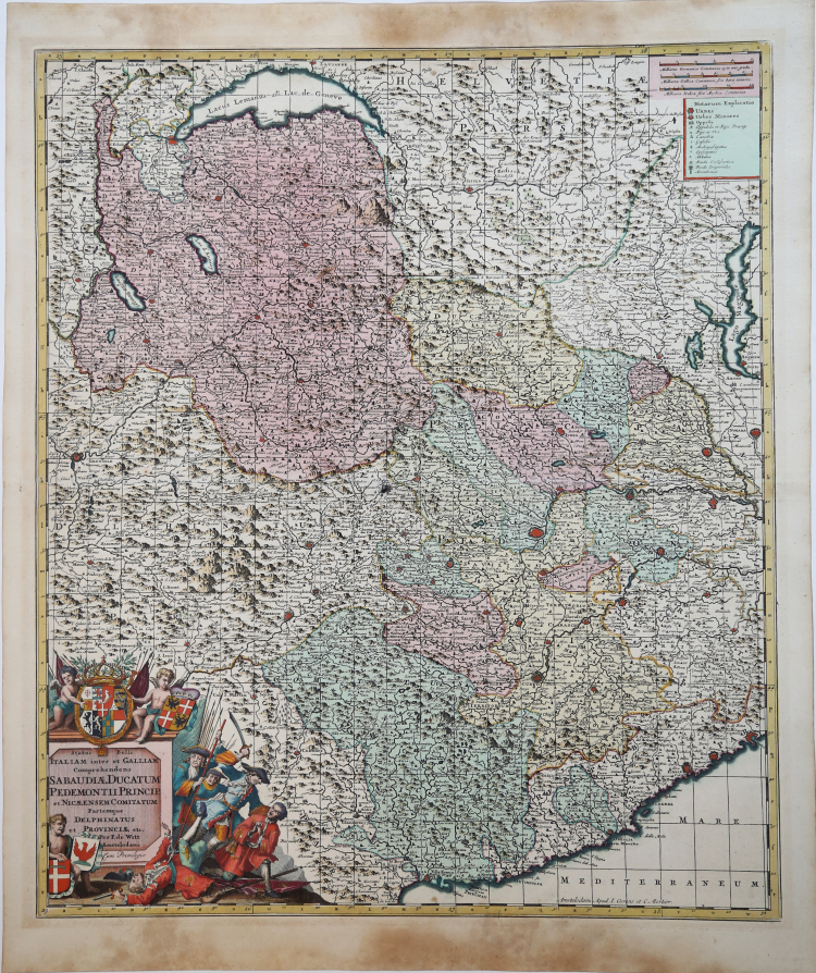
| Reference: | ms8407 |
| Author | Frederick de WIT |
| Year: | 1680 ca. |
| Zone: | Piedmont |
| Printed: | Amsterdam |
| Measures: | 490 x 570 mm |
| Reference: | ms8407 |
| Author | Frederick de WIT |
| Year: | 1680 ca. |
| Zone: | Piedmont |
| Printed: | Amsterdam |
| Measures: | 490 x 570 mm |
Edita per la prima volta dal De Wit nel 1680, la carta diviene subito molto popolare, e pertanto ristampata più volte. Sono infatti noti differenti stati di questa mappa.
Esemplare dello stato definitivo, edito sempre ad Amsterdam dagli eredi Covens e Mortier, databile pertanto circa al 1720.
De Wit era uno dei più importanti e rinomati incisori e editori di mappe di Amsterdam, nel periodo successivo al declino dell’attività di Blaeu e Jansson, dai quali aveva acquistato molte lastre quando vennero vendute all’asta. La sua opera, di considerevole bellezza dal punto di vista della grafica e della coloritura, venne stampata in numerose edizioni, persino dopo la sua morte, principalmente ad opera degli editori Covens e Mortier.
Incisione in rame, finemente colorata a mano, in eccellente stato di conservazione. Molto decorativa.
Frederick de WIT (1630 - 1706)
|
De Wit was one of the most prominent and successful map engravers and publishers in Amsterdam in the period following the decline of the Blaeu and Jansson establishments, from which he acquired many copper plates when they were dispersed at auction. His output covered most aspects of map making: sea charts, world atlases, an atlas of the Netherlands, 'town books' covering plans of towns and cities in the Netherlands and Europe, and wall maps. His work, notable for the beauty of the engraving and colouring, was very popular and editions were issued many years after his death by Pieter Mortier and Covens and Mortier.
|