
| Reference: | CO-450 |
| Author | Guillaume-Nicolas Delahaye |
| Year: | 1775 |
| Zone: | North and Central Italy |
| Printed: | Paris |
| Measures: | 335 x 405 mm |
| Reference: | CO-450 |
| Author | Guillaume-Nicolas Delahaye |
| Year: | 1775 |
| Zone: | North and Central Italy |
| Printed: | Paris |
| Measures: | 335 x 405 mm |
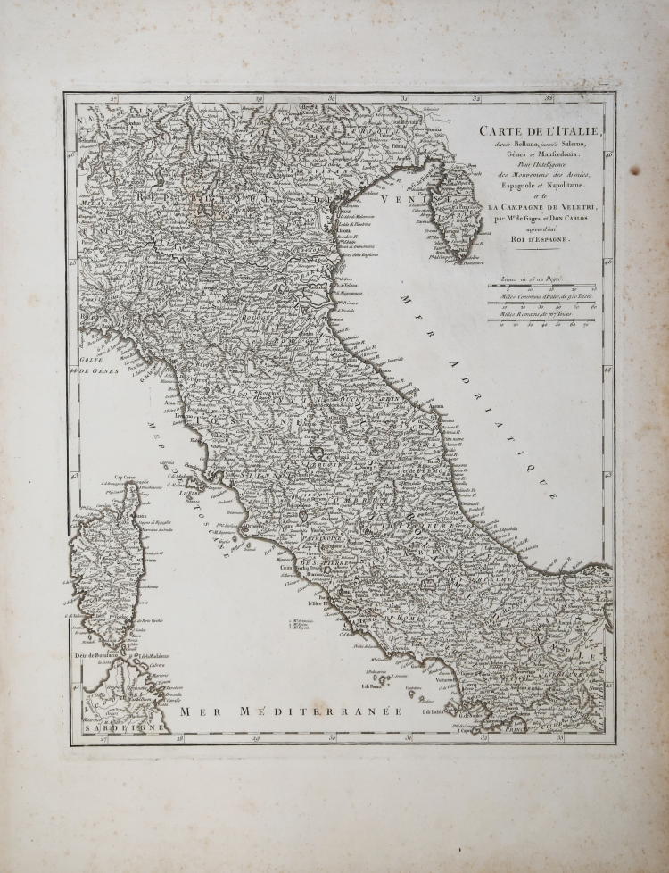
Carta geografica dell’Italia centro-settentrionale disegnata da Guillaume Nicolas De la Haye.
Tratta da Cartes géographiques, topographiques, plans, des Marches, Campemens, Villes, Sièges, Batailles, et de toutes les opérations militaires exécutées en Italie, pendant les Campagnes de 1745 & de 1746 par les Armées combineées de France et d'Espagne, commandées par M. le Maréchal de Maillebois sous les ordres de S.A.R. l'Infant Don Philippe [...] Dessinés et gravés par Guill. Dela-Haye, à Paris, de l'Imprimerie Royale, Parigi, 1775.
Guillaume-Nicolas Delahaye (1725 - 24 febbraio 1802) fu il membro più prolifico della famiglia di incisori Delahaye (De-La-Haye), attiva a Parigi per tutto il XVIII secolo. Dato che il nome Delahaye si traduce letteralmente in "dell'Aia", si può supporre che fossero ugonotti francesi costretti a fuggire dai Paesi Bassi sotto la minaccia di persecuzioni religiose. Nato a Parigi, era figlio del patriarca Jean-Baptiste Delahaye e fratello di Jean-Baptistie-Henri Delahaye. Si dice che il suo padrino, che lo tenne al fonte battesimale, fosse nientemeno che il famoso cartografo francese Guillaume de L'Isle. La famiglia Delahaye incise per molti dei grandi cartografi della Parigi del XVIII secolo, tra cui Jean-Baptiste Bourguignon d'Anville, Didier Robert de Vaugondy, Jean-Baptiste de Mannevillette e Jean-Nicolas Buache. Fu insignito della carica pubblica di Premier Graveur du Roi e lavorò a una serie di mappe che illustravano le cacce del re nei dintorni di Versailles. Guillaume collaborò anche con cartografi stranieri come Tomas Lopez di Madrid.
Acquaforte, in buono stato di conservazione.
Guillaume-Nicolas Delahaye (1725 - 1802)
|
Guillaume-Nicolas Delahaye (1725 - February 24, 1802) was the most prolific member of the Delahaye (De-La-Haye) family of engravers active in Paris throughout the 18th century. Given that the name, Delahaye literally translates to 'of the Hague' it can be assume they were French Huguenots who were forced to flee the Netherlands under threat of religious persecution. Born in Paris, he was the son of patriarch Jean-Baptiste Delahaye and brother to Jean-Baptistie-Henri Delahaye. It is said that his godfather, who held him at the baptismal font, was none other than the famous french cartographer Guillaume de L'Isle. The Delahaye family engraved for many of the great cartographers of 18th century Paris, including Jean-Baptiste Bourguignon d'Anville, Didier Robert de Vaugondy, Jean-Baptiste de Mannevillette, and Jean-Nicolas Buache, among others. He was awarded the public office Premier Graveur du Roi and worked on a series of maps illustrating the king's hunts around Versailles. Guillaume also worked with foreign cartographers such as Tomas Lopez of Madrid. Possibly Delahaye's most significant map is A Map of the Country between Albemarle Sound and Lake Erie prepared for the memories of Thomas Jefferson. He married in 1758. In total he engraved some 1200 maps. Delahaye died in Charenton. In 1792, his daughter, Antoinette Marie Delahaye (1773-1857), married the geographer Jean-Denis Barbie du Bocage.
|