
| Reference: | MS6248 |
| Author | Alvin Jewett JOHNSON |
| Year: | 1865 |
| Zone: | Sweden, Norway, Denmark |
| Printed: | New York |
| Measures: | 680 x 460 mm |
| Reference: | MS6248 |
| Author | Alvin Jewett JOHNSON |
| Year: | 1865 |
| Zone: | Sweden, Norway, Denmark |
| Printed: | New York |
| Measures: | 680 x 460 mm |
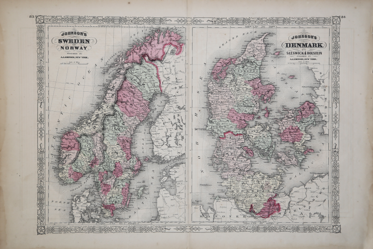
This is a magnificent 1865 hand colored map Scandinavia is divided into two parts.
The left map represents Norway and Sweden. The right map depicts Denmark as well as the provinces of Sleswick & Holstein. Depicts the area in considerable detail including both political and physical geographic features.
Map is dated and copyrighted, 'Entered according to Act of Congress in the Year of 1865 by A. J. Johnson in the Clerk's Office of the District Court of the United States for the Southern District of New York.'
Alvin Jewett JOHNSON (1827 - 1884)
|
Was a prolific American map publisher active from 1856 to the mid-1880s. Johnson was born into a poor family in Wallingford, Vermont where he received only a based public education. In 1861 ke moved in New York where he founded his publishing house in partnership with Browing, and then with Ward and later with his son.
|