| Reference: | VR78 |
| Author | Jan de LAT |
| Year: | 1747 |
| Zone: | Mediterranean Sea |
| Printed: | Deventer |
| Measures: | 460 x 175 mm |
| Reference: | VR78 |
| Author | Jan de LAT |
| Year: | 1747 |
| Zone: | Mediterranean Sea |
| Printed: | Deventer |
| Measures: | 460 x 175 mm |
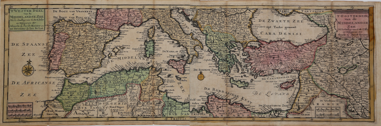
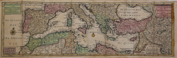
Two sheets map of the Mediterranea Sea taken from the "Atlas Portatif tres exact on livre de cartes geographiques... Weerelds Hand-Atlas" by Jan de LAT and Jacob KEIZER (Deventer and Almelo: 1747).
A rare pocket travelling atlas issued in Holland for the Dutch and French markets; including several maps of the world, the continents and Europe, based on de L'Isle's work. De Lat was one of the few booksellers outside Amsterdam who published maps and atlases, working at Deventer 1734-1750, and using as his engraver Jacob Keyzer of Almelo. Cf. Koeman Lat 7.
Jacob Keizer was a Dutch engraver and cartographer active in the first half of the 18th century. Little is known of his life, but it is assumed that he was active in Russia and Amsterdam, and later Almelo.
|
Cfr. C. Koeman, Atlas Neerlandici, LAT 7.
|
|
Jan de Lat (1734-1750) was publisher of maps and atlases and a bookseller from Deventer, Holland. Associated with the engraver Jacob Keizer, Jan de Lat published miniature atlases. He worked at Deventer between 1734 and 1750 with the engraver Jacob Keyzer from Almelo as his associate.
|
|
Cfr. C. Koeman, Atlas Neerlandici, LAT 7.
|
|
Jan de Lat (1734-1750) was publisher of maps and atlases and a bookseller from Deventer, Holland. Associated with the engraver Jacob Keizer, Jan de Lat published miniature atlases. He worked at Deventer between 1734 and 1750 with the engraver Jacob Keyzer from Almelo as his associate.
|