| Reference: | S30664 |
| Author | Allain Manneson MALLET |
| Year: | 1683 ca. |
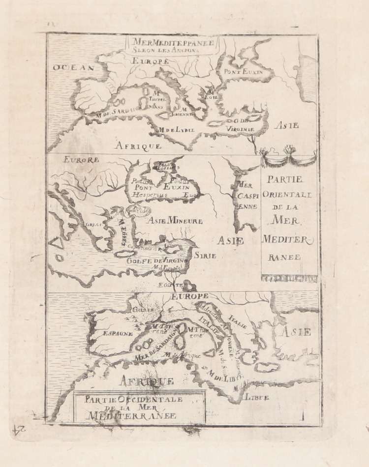
| Zone: | Mediterranean Sea |
| Printed: | Paris |
| Measures: | 120 x 155 mm |
| Reference: | S30664 |
| Author | Allain Manneson MALLET |
| Year: | 1683 ca. |
| Zone: | Mediterranean Sea |
| Printed: | Paris |
| Measures: | 120 x 155 mm |
Carta geografica tratta dal l'edizione tedesca del "Description de l'Univers, contenant les differents systêmes du monde, les cartes generales & particulieres de la geographie ancienne & moderne: les plans & les profils des principales villes & des autres lieux plus considerables de la Terre; avec les Portraits des Souverains qui y commandent, leurs Blasons, Titres & Livrées: Et les Moeurs, Religions, Gouvernemens & divers habillemens de chaque Nation. Dediée au Roy. Par Allain Manesson Mallet, Maistre de Mathematiques des Pages de la petite Escurie de sa Majesté, cy-devant Ingenieur & Sergent Major d'Artillerie en Portugal", stampato a Parigi da Denys Thierry nel 1683 e poi tradotto e ristampato a Colonia alla fine del secolo.
Incisione in rame, in ottimo stato di conservazione.
Allain Manneson MALLET (1630 - 1706)
|
Alain Manesson Mallet (1630-1706) was a French cartographer, grammarian, engineer and mathematician, active in the mid to late 17th century. Despite being born in France, as a young man Mallet joined the Portuguese – yes Portuguese – army where he served as a Sergeant-Major. Later he was able to levy his war experience into a career as Inspector of Fortifications for Louis XIV of France. It was in this position, where his work entailed examining and sketching various fortresses, that Mallet developed his cartographic interests. His most important work is his monumental five volume opus Description de L'Univers, published in 1683. This impressive work described the cultures, governments, lands, and customs of all the known peoples of the earth and included numerous maps and engravings. At the time, the Description was the largest and most comprehensive work of its kind ever published. A year later, in 1684, he published his 3 volume Les Travaux de Mars ou l'Art de la Guerre. Mallet is also known for his invention of the “dumpy bubble”, a telescopic sight incorporating a level bubble used for surveying and astronomical observations.
|