
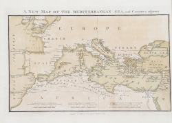
| Reference: | S11249 |
| Author | John LUFFMAN |
| Year: | 1816 |
| Zone: | Mediterranean Sea |
| Printed: | London |
| Measures: | 260 x 180 mm |
| Reference: | S11249 |
| Author | John LUFFMAN |
| Year: | 1816 |
| Zone: | Mediterranean Sea |
| Printed: | London |
| Measures: | 260 x 180 mm |
Chart of the Mediterranean sea from "LUFFMAN’S GEOGRAPHICAL & TOPOGRAPHICAL ATLAS, CONSISTING OF MAPS OF COUNTRIES, PLANS OF CITIES AND FORTS, PORTS AND HARBOURS, BATTLES &C." printed in London I. Luffman, Strand, [1816].
Copperplate, wonderful contemporary colour, in excellent condition. Very rare.
John LUFFMAN(attivo tra il 1776 e il 1820)
John LUFFMAN(attivo tra il 1776 e il 1820)