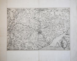
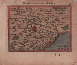
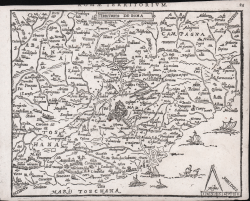
Campagna di Roma olim Latium
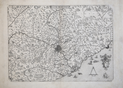
Campagna di Roma olim Latium
Sort by:
Showing 1-20 of 97 item(s)
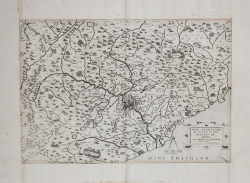
Giovanni Francesco CAMOCIO
Code:
CO-381
Measures:
480 x 330 mm
Year:
1559
Printed:
Venice
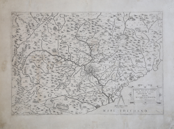
Vincenzo LUCHINI
Code:
CO-384
Measures:
455 x 325 mm
Year:
1560
Printed:
Rome
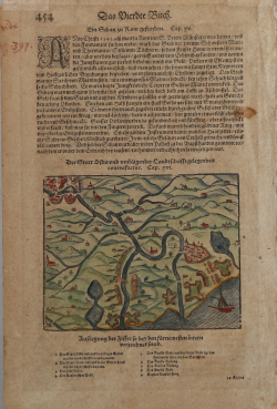
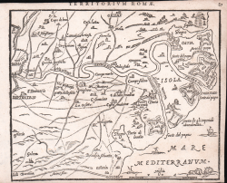
Sebastian Münster
Code:
S6733
Measures:
155 x 120 mm
Year:
1560 ca.
Printed:
Basle
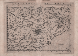
Girolamo RUSCELLI
Code:
CO-778
Measures:
270 x 200 mm
Year:
1561 ca.
Printed:
Venice
Ferrando BERTELLI
Code:
S29166
Measures:
460 x 312 mm
Year:
1563
Printed:
Venice
Ferrando BERTELLI
Code:
CO-382
Measures:
465 x 320 mm
Year:
1563
Printed:
Venice
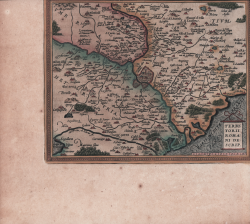
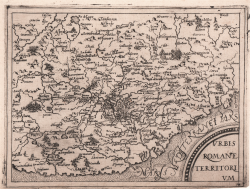
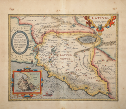
Abraham ORTELIUS
Code:
S42884
Measures:
240 x 190 mm
Year:
1570 ca.
Printed:
Antwerpen
Gerard DE JODE
Code:
CO-124
Measures:
510 x 380 mm
Year:
1578
Printed:
Antwerpen
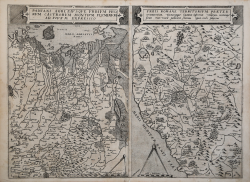
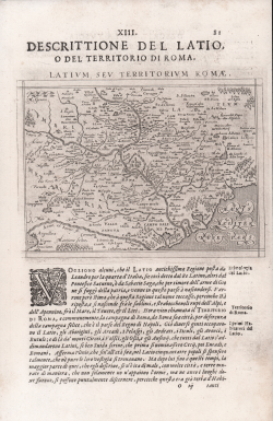
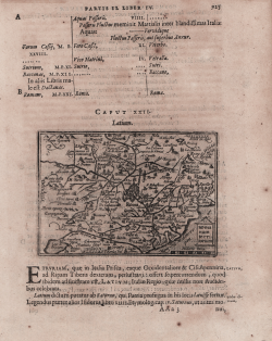
Jean Matal METELLUS
Code:
CO-582
Measures:
197 x 150 mm
Year:
1579 ca.
Printed:
Cologne
Jean Matal METELLUS
Code:
CO-025
Measures:
200 x 150 mm
Year:
1579 ca.
Printed:
Cologne
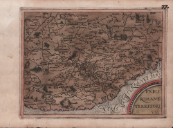
Abraham ORTELIUS - Philip GALLE
Code:
S8026
Measures:
105 x 75 mm
Year:
1583 ca.
Printed:
Antwerpen
Vincenzo LUCHINI
Code:
CO-082
Measures:
450 x 320 mm
Year:
1585 ca.
Printed:
Rome
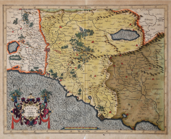
Gerard MERCATOR (Kremer)
Code:
s27293
Measures:
470 x 370 mm
Year:
1589 ca.
Printed:
Duisburg
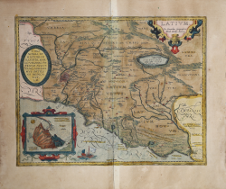
Abraham ORTELIUS
Code:
S30041
Measures:
455 x 355 mm
Year:
1595 ca.
Printed:
Antwerpen
Abraham ORTELIUS
Code:
S46094
Measures:
455 x 360 mm
Year:
1595
Printed:
Antwerpen
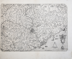
Giovanni Antonio MAGINI
Code:
CO-602
Measures:
175 x 125 mm
Year:
1596 ca.
Printed:
Venice
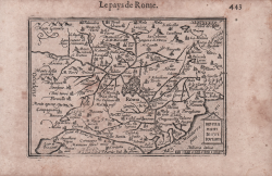
Zacharias HEYNS
Code:
CO-015
Measures:
190 x 150 mm
Year:
1598
Printed:
Amsterdam
Zacharias HEYNS
Code:
CO-016
Measures:
185 x 150 mm
Year:
1598
Printed:
Amsterdam
Jodocus HONDIUS
Code:
S27020
Measures:
120 x 85 mm
Year:
1598 ca.
Printed:
Amsterdam
Barent LANGENES
Code:
CO-975
Measures:
125 x 95 mm
Year:
1598 ca.
Printed:
Amsterdam