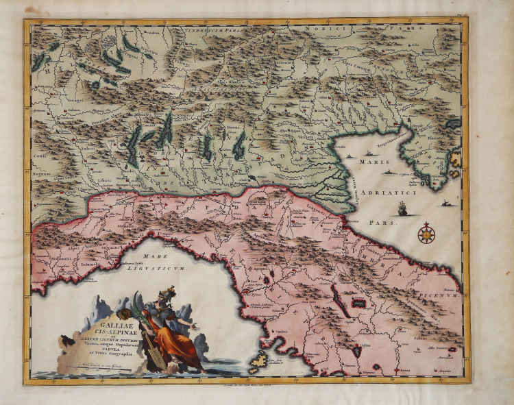
| Reference: | s6459 |
| Author | Pieter VANDER AA |
| Year: | 1705 ca. |
| Zone: | Northern Italy |
| Printed: | Leyden |
| Measures: | 415 x 345 mm |
| Reference: | s6459 |
| Author | Pieter VANDER AA |
| Year: | 1705 ca. |
| Zone: | Northern Italy |
| Printed: | Leyden |
| Measures: | 415 x 345 mm |
Map of the Roman province called Gallia Cisalipina, which extended from the Alps sea and consequently comprised Italy as far as the Rubicon. Taken from the “Thesaurus Antiquitatum et Historiarum Italiae, Neapolis, Siciliae Sardiniae….” by Georgius Graevius, published at the beginnings of the eighteenth century.
Copperplate with fine later hand colour, in very good conditions.
Pieter VANDER AA (1659 - 1733)
|
Records show that van der Aa, born in Leyden in 1659, made an early start in life by being apprenticed to a bookseller at the age of nine and starting on his own in business as a book publisher by the time he was twenty-three.
During the following fifty years he published an enormous amount of material, including atlases and illustrated works in every shape and size, two of them consisting of no less than 27 and 28 volumes containing over 3,000 maps and plates.
Most of his maps were not of the first quality and were certainly not original, but they are often very decorative and are collected on that account.
|