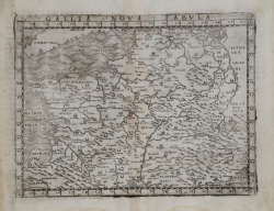
Gallia Nova Tabula Giacomo GASTALDI Code: s13365 Measures: 180 x 135 mm Year: 1548 ca. Printed: Venice Price €325.00 Quick view View Details
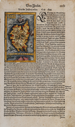
Von der Inseln Corsica Sebastian Münster Code: s26614 Measures: 150 x 260 mm Year: 1550 ca. Printed: Basle Price €150.00 Quick view View Details
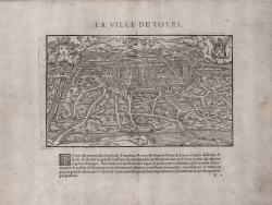
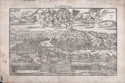
La Ville de Tours Guillaume GUEROULT Code: S22255 Measures: 265 x 160 mm Year: 1552 ca. Printed: Lyon Price €400.00 Quick view View Details
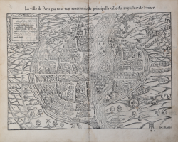
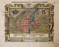
La ville de Paris, par tout tant renommée, & principalle ville du... Sebastian Münster Code: S48015 Measures: 390 x 315 mm Year: 1552 Printed: Basle Price €750.00 Quick view View Details
La Ville de Lyon Guillaume GUEROULT Code: s22252 Measures: 255 x 160 mm Year: 1553 ca. Printed: Lyon Price €500.00 Quick view View Details
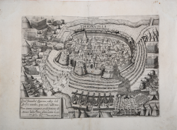
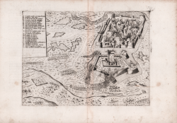
Thionville Nicolas Beatrizet detto BEATRICETTO Code: S40845 Measures: 425 x 310 mm Year: 1558 Printed: Rome Price €1,750.00 Quick view View Details
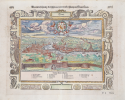
Leon Sebastian Münster Code: S4557 Measures: 320 x 250 mm Year: 1560 ca. Printed: Basle Price €180.00 Quick view View Details
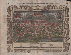
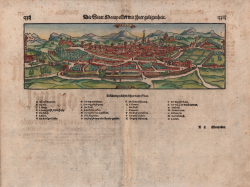
Tours Sebastian Münster Code: S17192 Measures: 340 x 250 mm Year: 1560 ca. Printed: Basle Price €250.00 Quick view View Details
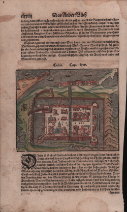
Cales Sebastian Münster Code: s17158 Measures: 160 x 130 mm Year: 1560 ca. Printed: Basle Price €100.00 Quick view View Details
Die Statt Montpellier mit ihrer gelegenheit Sebastian Münster Code: S17189 Measures: 395 x 325 mm Year: 1560 ca. Printed: Basle Price €200.00 Quick view View Details
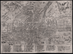
Parise Paolo FORLANI Code: s22224 Measures: 260 x 190 mm Year: 1567 Printed: Venice Price €750.00 Quick view View Details
Metz Domenico ZENOI Code: S4663 Measures: 278 x 205 mm Year: 1567 Printed: Venice Price €500.00 Quick view View Details
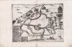
Guines Paolo FORLANI Code: MS7255 Measures: 280 x 209 mm Year: 1569 Printed: Venice Price €400.00 Quick view View Details
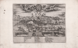
Lion Donato BERTELLI Code: S45205 Measures: 270 x 200 mm Year: 1569 Printed: Venice Price €750.00 Quick view View Details
Die Statt Paris etlicher maß figuriert und contrafehtet nach... Sebastian Münster Code: s35024 Measures: 330 x 260 mm Year: 1570 ca. Printed: Basle Price €500.00 Quick view View Details
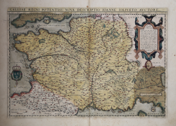
Galliae Regni Potentiss: Nova Descriptio.. Abraham ORTELIUS Code: S4959 Measures: 507 x 351 mm Year: 1570 ca. Printed: Antwerpen Price €500.00 Quick view View Details
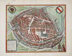
Argentoratum Georg BRAUN & Franz HOGENBERG Code: S49238.99 Measures: 420 x 340 mm Year: 1572 ca. Printed: Antwerpen & Cologne Price €600.00 Quick view View Details New
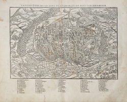
La peincture de la Cite de Colmar et du pays circonvoisin Francois de BELLEFOREST Code: MS4053 Measures: 350 x 235 mm Year: 1575 Printed: Paris Price €275.00 Quick view View Details
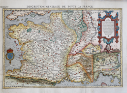
Description Generale de Toute la France Francois de BELLEFOREST Code: MS3229 Measures: 510 x 340 mm Year: 1575 Printed: Paris Price €750.00 Quick view View Details
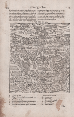
Vvircebourg Francois de BELLEFOREST Code: MS4043 Measures: 168 x 195 mm Year: 1575 Printed: Paris Price €125.00 Quick view View Details