| Reference: | S43996 |
| Author | Athanasius KIRCHER |
| Year: | 1667 |
| Zone: | Asia |
| Printed: | Amsterdam |
| Measures: | 525 x 420 mm |
| Reference: | S43996 |
| Author | Athanasius KIRCHER |
| Year: | 1667 |
| Zone: | Asia |
| Printed: | Amsterdam |
| Measures: | 525 x 420 mm |
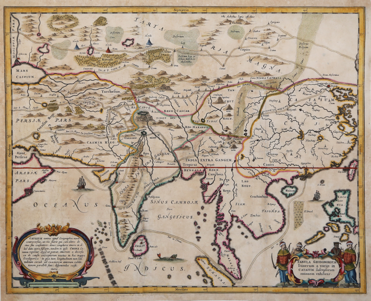
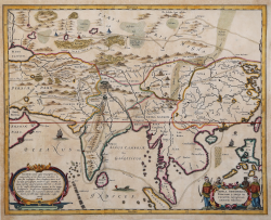
Athanasius Kircher map of Asia illustrating several routes from the Middle East to China.
The map depicts the continent from the Caspian Sea, Persia, the Persian Gulf, and the Arabian Peninsula to the Pacific Ocean and from Siberia to the Indian Ocean.
Kircher's map is based on reports and testimony from Jesuit missionaries who had been to China, as Kircher himself had never made the voyage. At least four different overland transcontinental routes are presented, with waypoints, settlements, and towns labeled along each one. One sea route takes the traveler from the Strait of Hormuz, through the Arabian Sea, around India and through the strait separating India from Sri Lanka, then across the Bay of Bengal and through the Strait of Malacca and finally around the Indochinese peninsula to Macau. China, Tibet, Persia, Siam, Hainan, and 'Tartaria Magna' are among the labeled regions, and cities, such as Beijing, (Pequin), Malacca City, Johor Bahru (Iohor), and Macau (Macao) are also labeled. Swamps, forests, and mountain ranges allow the viewer to have some understanding of the terrain, along with the rivers that snake their way across the continent.
Published in Kircher's celebrated work Athanasii Kircheri e Soc. Jesu China monumentis, known as China Illustrata,
Athanasius Kircher (1601-1680) was one of the great scholars and travel writers of his time. A German born Jesuit scholar, he has been described as inventor, composer, geographer, geologist, Egyptologist, historian, adventurer, philosopher, proprietor of one of the first public museums, physicist, mathematician, naturalist, astronomer, archaeologist, and author of more than 40 published works. Kircher began teaching mathematics, ethics, and ancient languages at the University of Würzburg. In 1630 and 1637, Kircher petitioned to travel to China, but was unsuccessful in both requests, instead, his China Illustrata, first published in 1667, was a compilation of the most important works of the period, including Martino's Atlas of China published by Blaeu (1655), and the Journals of Matteo Ricci (1552-1610), Alvaro Semedo (1586-1658), Michael Boym (1612-1659 and Melchisedech Thevenot.
Athanasius KIRCHER (Geisa 1601 circa - Roma 1680)
|
German Jesuit educated in Fulda, was one of the most remarkable men of his time, seemingly interested in every aspect of life. He was an expert on China and its languages; Egypt and Ethiopia and the source of the Nile; he translated oriental scripts and hieroglyphics; made a scientific study of the evolution of the earth and its physical features; he wrote a treatise on the reasons of magnetic compass variations; and, in the middle of all of that, found time to invent the magic lantern, for which he is probably best remembered. Maps in his book Mundus Subterraneus were the first to describe tides and ocean currents beside showing the sites of all volcanoes known at that time.
|