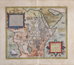
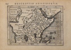
Presbiteri Iohannis, Sive, Abissinorum Imperii Descriptio Abraham ORTELIUS Code: S46129 Measures: 440 x 375 mm Year: 1587 ca. Printed: Antwerpen Price €800.00 Quick view View Details
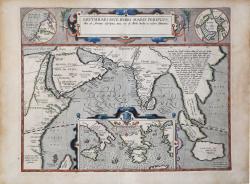
Erythraei Sive Rubri Maris Periplus Abraham ORTELIUS Code: S4773 Measures: 475 x 370 mm Year: 1597 ca. Printed: Antwerpen Price €900.00 Quick view View Details
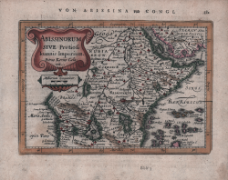
Abissinorum Sive Pretiosi Ioannis Imperiu Jodocus HONDIUS Code: ms3929 Measures: 490 x 340 mm Year: 1606 ca. Printed: Amsterdam Price €600.00 Quick view View Details
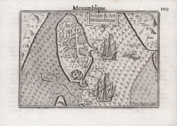
Insulae & Ars Mosambique Barent LANGENES Code: S50650 Measures: 125 x 85 mm Year: 1609 Printed: Frankfurt Price €125.00 Quick view View Details
Abissinorum Imperium Jodocus HONDIUS Jr. Code: MS2361 Measures: 135 x 95 mm Year: 1616 Printed: Amsterdam Price €150.00 Quick view View Details
Abissinorum sive Pretiosi Ioannis Imperium Johannes JANSSONIUS Code: S48201 Measures: 195 x 135 mm Year: 1628 ca. Printed: Amsterdam Price €180.00 Quick view View Details
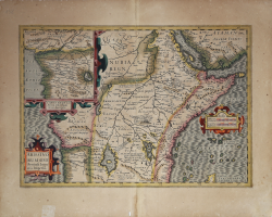
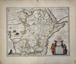
Aethiopia Superior vel interior, vulgo Abissinorum… Johannes JANSSONIUS Code: mms1017 Measures: 490 x 390 mm Year: 1640 ca. Printed: Amsterdam Price €600.00 Quick view View Details
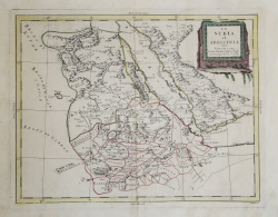
Abissinia dove sono le Fonti del Nilo Vincenzo CORONELLI Code: S42895 Measures: 610 x 460 mm Year: 1690 ca. Printed: Venice Price €475.00 Quick view View Details
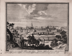
Amara, een voorname Stadt… / Amara, Abyssinae sive interioris... Pieter SCHENK Code: S40013 Measures: 265 x 215 mm Year: 1702 ca. Printed: Amsterdam Price €130.00 Quick view View Details
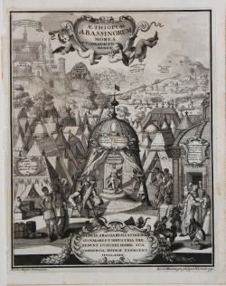
Aethiopum Abassinorum mores et consuetudines Henrick SCHERER Code: MS5733 Measures: 195 x 245 mm Year: 1703 Printed: Munich Price €180.00 Quick view View Details
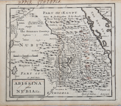
Abissinia and Nubia & c. Herman MOLL Code: MS5868 Measures: 198 x 180 mm Year: 1720 ca. Printed: London Price €100.00 Quick view View Details
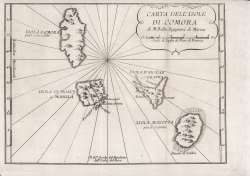
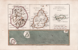
Carte dell'Isole di Comora Jacques Nicolas BELLIN Code: S50047 Measures: 250 x 180 mm Year: 1751 ca. Printed: Venice Price €100.00 Quick view View Details
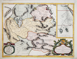
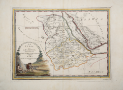
La Nubia ed Abissinia Antonio ZATTA Code: S4862 Measures: 415 x 325 mm Year: 1784 Printed: Venice Price €130.00 Quick view View Details
Cartes générale et particulières des Isles de France, de Bourbon et... Rigobert BONNE Code: MS1818 Measures: 355 x 230 mm Year: 1787 Printed: Paris Price €200.00 Quick view View Details
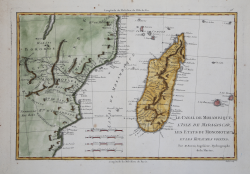
Le Canal de Mosambique, l'Isle de Madagascar, les Etats du... Rigobert BONNE Code: S4624 Measures: 362 x 250 mm Year: 1787 Printed: Paris Price €100.00 Quick view View Details
La Nubia ed Abissinia delienata sulle ultime osservazioni Giovanni Maria CASSINI Code: s31493 Measures: 495 x 368 mm Year: 1798 Printed: Rome Price €350.00 Quick view View Details
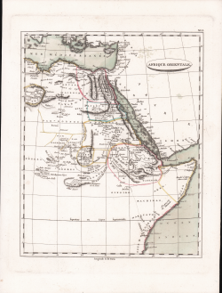
Afrique Orientale Jean-Nicolas Buache Code: S45300 Measures: 220 x 280 mm Year: 1804 Printed: Paris Price €70.00 Quick view View Details
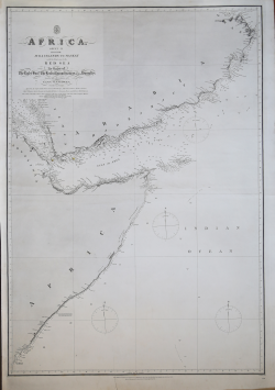
Africa, sheet VI from the Juba Island to Maskat with the netrance... John WALKER Code: S28387 Measures: 650 x 960 mm Year: 1826 ca. Printed: London Price €250.00 Quick view View Details