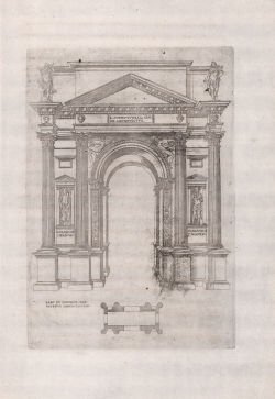
Larc de Veronne, Par Vitruve Larchitecteur (Arco dei Gavi)
Jacques Androuet du CERCEAU
Code:
S41624
Measures:
205 x 300 mm
Year:
1545 ca.
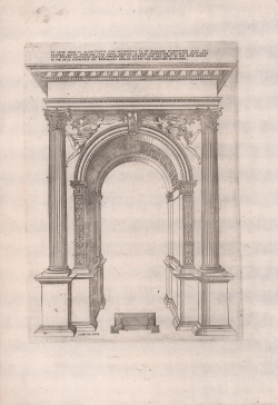
Larc de Suse (Arch of Augustus - Susa)
Jacques Androuet du CERCEAU
Code:
S41611
Measures:
213 x 300 mm
Year:
1545 ca.
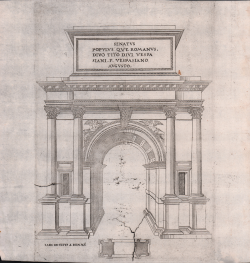
Larc de Titus a Romme (Arch of Titus in Rome)
Jacques Androuet du CERCEAU
Code:
S41568
Measures:
205 x 300 mm
Year:
1545 ca.
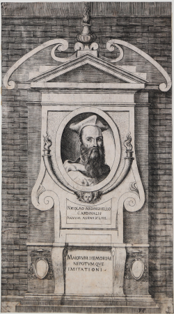
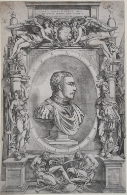
Portrait of Niccolò Ardinghelli
Giulio BONASONE
Code:
S40261.5
Measures:
176 x 319 mm
Year:
1547 ca.
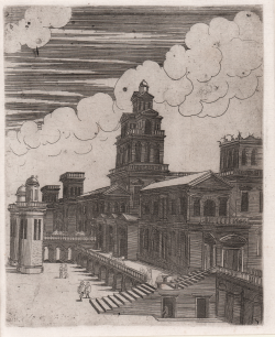
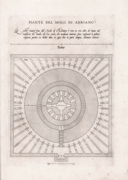
Piante del Molo di Adriano
Antonio LABACCO
Code:
S45244
Measures:
230 x 330 mm
Year:
1552 ca.
Printed:
Rome
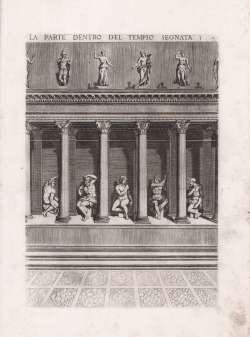
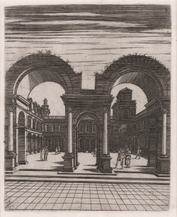
La parte dentro del Tempio segnata
Antonio LABACCO
Code:
S45240
Measures:
225 x 320 mm
Year:
1552 ca.
Printed:
Rome
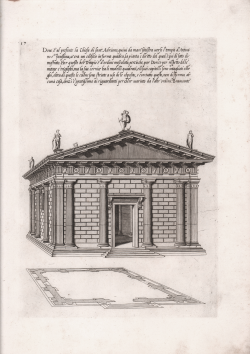
Dove è al presente la Chiesa di Sant'Adriano...
Antonio LABACCO
Code:
S45238
Measures:
235 x 330 mm
Year:
1552 ca.
Printed:
Rome
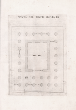
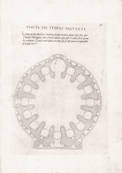
Pianta del Tempio Seguente
Antonio LABACCO
Code:
S45234
Measures:
210 x 290 mm
Year:
1552 ca.
Printed:
Rome
Pianta del Seguente Tempio
Antonio LABACCO
Code:
S45230
Measures:
235 x 330 mm
Year:
1552 ca.
Printed:
Rome
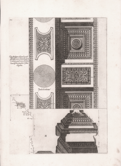
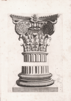
Questa figura dinota li quadri sfondati, overo i lacunarij, sopra...
Antonio LABACCO
Code:
S45228
Measures:
240 x 335 mm
Year:
1552 ca.
Printed:
Rome
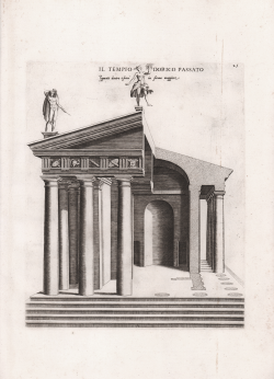
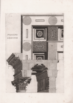
Il Tempio Dorico Passato figurato dentro e fuori in forma maggiore
Antonio LABACCO
Code:
S45226
Measures:
235 x 280 mm
Year:
1552 ca.
Printed:
Rome
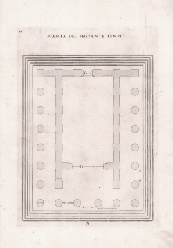
Pianta del Tempio Seguente
Antonio LABACCO
Code:
S45225
Measures:
230 x 310 mm
Year:
1552 ca.
Printed:
Rome
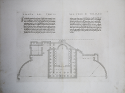
Pianta del Tempio nel Foro di Traiano
Antonio LABACCO
Code:
S45249
Measures:
425 x 330 mm
Year:
1552 ca.
Printed:
Rome