| Reference: | S7688 |
| Author | Pieter VANDER AA |
| Year: | 1723 ca. |
| Zone: | Corsica |
| Printed: | Leyden |
| Measures: | 385 x 310 mm |
| Reference: | S7688 |
| Author | Pieter VANDER AA |
| Year: | 1723 ca. |
| Zone: | Corsica |
| Printed: | Leyden |
| Measures: | 385 x 310 mm |
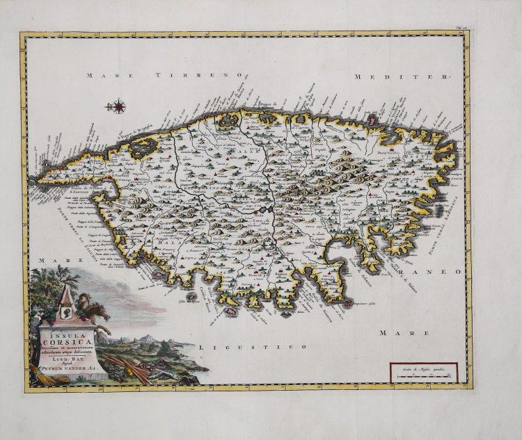
Carta geografica tratta dal “Thesaurus Antiquitatum et Historiarum Italiae, Neapolis, Siciliae Sardiniaae, Corsicae e Melitae”, monumentale opera di Georgius Graevius pubblicata nel primo quarto del XVIII secolo.
Tra il 1704 e il 1725 sono stampati a Leida i 45 volumi del "Thesaurus antiquitatum", generazione complessa, laboriosa, esaltata da alcuni come straordinaria, criticata, invece, da altri, che ne parlarono come di una "compilation énorme sans choix e sans ordre ". Un progetto che ha riguardato molto i contemporanei, in Italia, ma che ha interessato poco storiografia dopo che, tranne rari casi, ne ha sottolineato il carattere meramente erudito e la sostanziale inutilità.
L'opera di Graevius è tuttavia arricchita dalle prezione tavole firmate dall'editore olandese Pieter Vander AA.
Incisione in rame, in buono stato di conservazione.
Pieter VANDER AA (1659 - 1733)
|
Records show that van der Aa, born in Leyden in 1659, made an early start in life by being apprenticed to a bookseller at the age of nine and starting on his own in business as a book publisher by the time he was twenty-three.
During the following fifty years he published an enormous amount of material, including atlases and illustrated works in every shape and size, two of them consisting of no less than 27 and 28 volumes containing over 3,000 maps and plates.
Most of his maps were not of the first quality and were certainly not original, but they are often very decorative and are collected on that account.
|