| Reference: | S21205 |
| Author | Giovanni Battista CINGOLANI |
| Year: | 1704 |
| Zone: | Latium |
| Printed: | Rome |
| Measures: | 1950 x 1220 mm |
| Reference: | S21205 |
| Author | Giovanni Battista CINGOLANI |
| Year: | 1704 |
| Zone: | Latium |
| Printed: | Rome |
| Measures: | 1950 x 1220 mm |
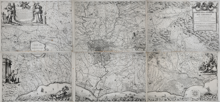
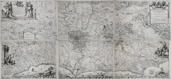
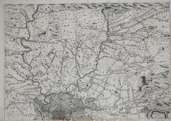
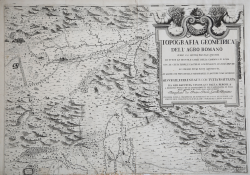
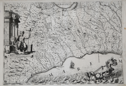
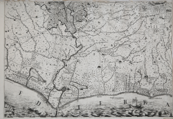
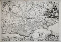
Topografia geometrica dell' Agro romano, ouero, La misura, pianta, e quantita di tutte le tenute e casali della campagna di Roma : con le citta, terre e castelli confinanti ad esse tenute : le strade, fiumi, fossi, aquedotti et altre cose principali e memorabili, si antiche come moderne / misurate e delineate con tutta esattezza da Gio. Battista Cingolani dalla Pergola Romano ; intagliata da Pietro Paolo Girelli Romano, l'anno MDCLXXXXII.
Cadastral map of the area around Rome, drawn by the surveyor Cingolani. First published 1692 by Matteo Gregorio de Rossi, with Cingolani's dedication to Pope Innocent XII. Reissued 1704 by Domenico de Rossi, with dedication by Domenico's son Lorenzo Filippo to Marchese Francesco Maria Ruspoli.
After carefully following the project for the enlargement and arrangement of Rome, Pope Alexander VII (Fabio Chigi) commissioned several topographers and agronomists to form the cadastre of the Agro Romano, giving the Jesuit Francesco Eschinardi the task of directing the cartographic part.
Eschinardi entrusted the task to the Urbino agrarian surveyor Giovanni Battista Cingolani, who produced a valuable survey, which came to press for the first time in 1692, edited by Matteo Gregorio de Rossi and engraved by Pietro Paolo Girelli.
A second, identical edition of the map, this time edited by Domenico De Rossi, was printed in 1704. Later Father Ridolfino Venuti publishes the map with an addenda containing the alphabetical catalog of the estates with the names of the owners and the area of each. The map is reprinted in 1770 by the Calcografia Camerale; director Giovanni Domenico Campiglia signs the "booklet" accompanying the map that contains the Index of Names. On the last page of the index we find the imprint: Nella Calcografia Pontificia l'anno MDCCLXX Alle Calende di Settembre, del Pontificato di N. S. Clemente XIV Anno Secondo.
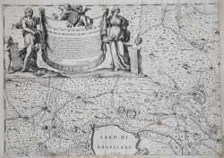
Example of the second state of the map, with the date 1704 and the imprint of Domenico De Rossi. In the cartouche at upper left the dedication of Lorenzo Filippo to Marchese Francesco Maria Ruspoli.
Magnificent example of this very important relief on the region.
Bibliografia
Almagià, Documenti Cartografici dello Stato Pontificio p. 40/41, tav. LXX/LXXII. Istituto di Studi Romani, a cura di A. Frutaz, Le Carte del Lazio, XXXII.1, tavv. 160-166.
Giovanni Battista CINGOLANI
Giovanni Battista CINGOLANI