| Reference: | S14092 |
| Author | Gilles Robert de VAUGONDY |
| Year: | 1750 ca. |
| Zone: | Calabria & Sicily |
| Printed: | Paris |
| Measures: | 625 x 490 mm |
| Reference: | S14092 |
| Author | Gilles Robert de VAUGONDY |
| Year: | 1750 ca. |
| Zone: | Calabria & Sicily |
| Printed: | Paris |
| Measures: | 625 x 490 mm |
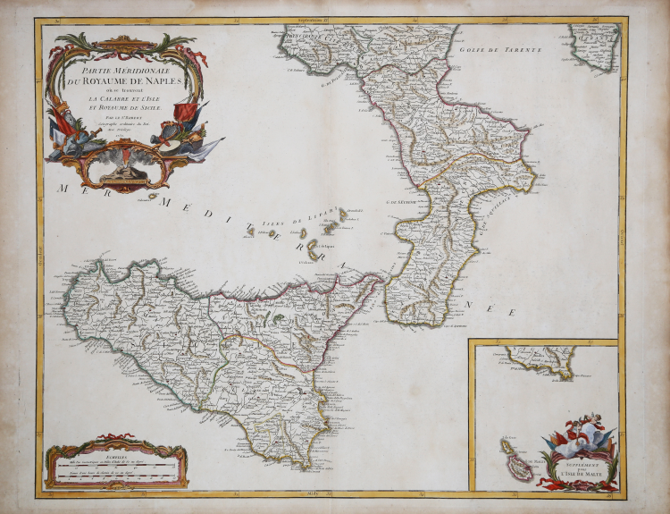
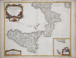
This is an attractive 1750 map of southern Italy by Robert de Vaugondy. It covers the southern regions of the territories claimed by the Kingdom of Naples and extends from Agropoli south to include the island of Sicily. An inset in the bottom right quadrant features the Isle of Malta. Mt. Etna, the tallest active volcano in the region, is beautifully rendered. Sicily became a Greek colony around 750 BC and according to Greek mythology, the monster Typhon, is trapped under Mount Etna.
Several important towns, cities, roads, rivers, lakes and other topographical features are noted throughout. A beautifully illustrated title cartouche adorns the top left quadrant of the map as well as the bottom right quadrant of the inset. This map was drawn by Robert de Vaugondy in 1750 and published in the 1757 issue of his Atlas Universal. The Atlas Universal was one of the first atlases based upon actual surveys. Therefore, this map is highly accurate (for the period) and has most contemporary town names correct.
Copperplate with fine later hand colour, good condition.
Gilles Robert de VAUGONDY (1688 - 1766)
|
Didier Robert de Vaugondy (1723-1786) was appointed Geographer to Louis XV in 1760. At the same time, de Vaugondy served as Geographer to the Duke of Lorraine and Bar, father-in-law to Louis XV and former King of Poland.
His major contributions to French cartography are the Atlas Universel, 1750-57, The Nouvelle Atlas Portatif (1784) and a very popular map of North America published in 1761. He was son of Gilles Robert de Vaugondy who succeeded Pierre Sanson as the King's Geographer.
|