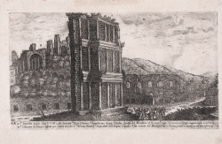
Veduta del Settizonio di Settimio Severo Aloisio GIOVANNOLI Code: S50134 Measures: 375 x 215 mm Year: 1616 Printed: Rome Price €250.00 Quick view View Details
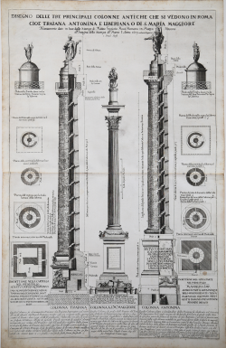
Disegno delle tre principali colonne antiche che si vedono in Roma Matteo Gregorio De ROSSI Code: S41973 Measures: 447 x 690 mm Year: 1689 Price €600.00 Quick view View Details
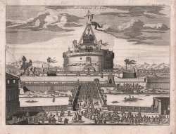
Le Chateau S. Ange Anonimo - Scuola Francese Code: S46324 Measures: 290 x 215 mm Year: 1700 ca. Printed: Paris Price €150.00 Quick view View Details
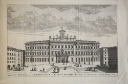
Veue du Palais de la Grand Curia au Mont Citorioa Rome… Pierre MORTIER Code: S40591 Measures: 675 x 450 mm Year: 1704 Printed: Amsterdam Price €575.00 Quick view View Details
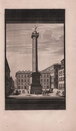
(Colonna Antonina) Franciscus HALMA Code: S31346 Measures: 170 x 280 mm Year: 1704 Printed: Amsterdam Price €100.00 Quick view View Details
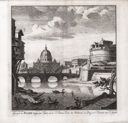
Gezigt te Rome langs den Tyber op de S. Peters Kerk, het Vatikaan,... Pieter SCHENK Code: S44178 Measures: 180 x 190 mm Year: 1705 Price €150.00 Quick view View Details
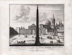
Porta Flaminia Pieter SCHENK Code: S44185 Measures: 195 x 170 mm Year: 1705 Price €150.00 Quick view View Details
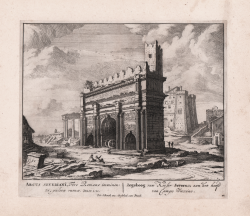
Arcus Severiani... Pieter SCHENK Code: S34772 Measures: 195 x 170 mm Year: 1705 Printed: Amsterdam Price €150.00 Quick view View Details
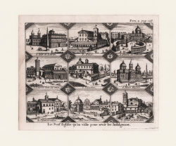
Les Neuf Eglises qu'on visite pour avoir les Indulgences Alexandre de ROGISSART Code: S369600 Measures: 170 x 140 mm Year: 1706 Price €150.00 Quick view View Details
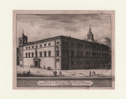
Palais de la Saience, et College public de Rome Alexandre de ROGISSART Code: S34764 Measures: 165 x 130 mm Year: 1706 Price €80.00 Quick view View Details
Palais du Prince Iustinianu sur la Place de S. Louis des Francois Alexandre de ROGISSART Code: S6816 Measures: 160 x 130 mm Year: 1706 Price €70.00 Quick view View Details
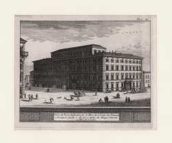
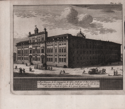
College Romain de la Compagnie de Iesus, fondé par le Pape Grégoire... Alexandre de ROGISSART Code: S45931 Measures: 160 x 135 mm Year: 1706 Printed: Leyden Price €70.00 Quick view View Details
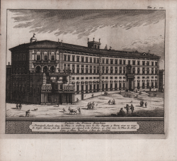
Palais Farnese du Sereniss. Duc de Parma Alexandre de ROGISSART Code: S45930 Measures: 165 x 150 mm Year: 1706 Printed: Leyden Price €80.00 Quick view View Details
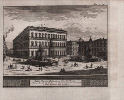
Palais Barberin du Prince de Palestrine sur le Mont Quirinal Alexandre de ROGISSART Code: S45928 Measures: 165 x 130 mm Year: 1706 Printed: Leyden Price €70.00 Quick view View Details
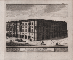
Palais et College de Propaganda Fide Alexandre de ROGISSART Code: S45927 Measures: 165 x 150 mm Year: 1706 Printed: Leyden Price €70.00 Quick view View Details
Palais du Prince Borghese Alexandre de ROGISSART Code: S45926 Measures: 165 x 135 mm Year: 1706 Printed: Leyden Price €70.00 Quick view View Details
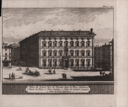
Palais du Grand Duc de Toscane dans la Place Madama Alexandre de ROGISSART Code: S45925 Measures: 160 x 155 mm Year: 1706 Printed: Leyden Price €80.00 Quick view View Details
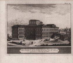
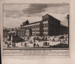
Palais du Pape dans le Quirinal dit Monte Cavallo Alexandre de ROGISSART Code: S45924 Measures: 165 x 140 mm Year: 1706 Printed: Leyden Price €80.00 Quick view View Details
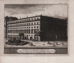
Palais du Prince Chigi dans la Place Colonne Alexandre de ROGISSART Code: S45923 Measures: 170 x 140 mm Year: 1706 Printed: Leyden Price €80.00 Quick view View Details
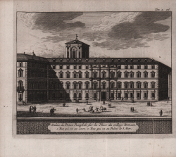
Palais du Prince Pamphile sur la Place du College Romain Alexandre de ROGISSART Code: S45929 Measures: 160 x 140 mm Year: 1706 Printed: Leyden Price €70.00 Quick view View Details