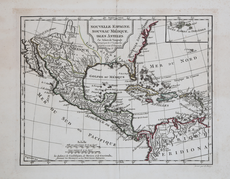

| Reference: | MS2815 |
| Author | Didier Robert de VAUGONDY |
| Year: | 1748 ca. |
| Zone: | Mexico |
| Printed: | Paris |
| Measures: | 320 x 260 mm |
| Reference: | MS2815 |
| Author | Didier Robert de VAUGONDY |
| Year: | 1748 ca. |
| Zone: | Mexico |
| Printed: | Paris |
| Measures: | 320 x 260 mm |
Taken from the "Nouvel Atlas Portat" by Vaugondy, corrected by Delamarche, 1789.
The Nouvel Atlas Portatif was Didier Robert de Vaugondy's only independent atlas venture, without any financial backing from others. It was designed specifically for educating young students, and is prefaced with "Discours sur l'etude de la Geographie" in which he laid out his philosophy of teaching children geography.
Copper engraving, fine outline colour, in excellent condition.
Didier Robert de VAUGONDY (1723 ca. - 1786)
|
Didier Robert de Vaugondy (1723-1786) was appointed Geographer to Louis XV in 1760. At the same time, de Vaugondy served as Geographer to the Duke of Lorraine and Bar, father-in-law to Louis XV and former King of Poland.
His major contributions to French cartography are the Atlas Universel, 1750-57, The Nouvelle Atlas Portatif (1784) and a very popular map of North America published in 1761. He was son of Gilles Robert de Vaugondy who succeeded Pierre Sanson as the King's Geographer.
|