Maps and General Views of Rome
Maps and General Views of Rome
Sort by:
Showing 1-20 of 98 item(s)
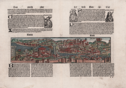
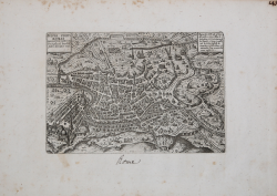
Giacomo Filippo FORESTI
Code:
s20988
Measures:
210 x 300 mm
Year:
1490 ca.
Printed:
Venice
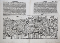
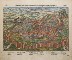
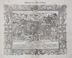
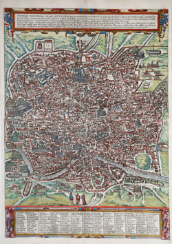
Hartmann SCHEDEL
Code:
S11869
Measures:
590 x 410 mm
Year:
1493
Printed:
Nurnberg
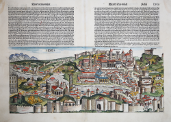
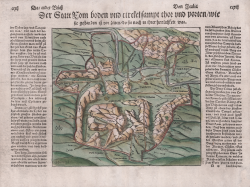
Hartmann SCHEDEL
Code:
S46328
Measures:
535 x 225 mm
Year:
1493
Printed:
Nurnberg
Johann Schönsperger
Code:
s29425
Measures:
350 x 100 mm
Year:
1496
Printed:
Basle
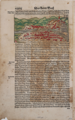
Sebastian Münster
Code:
S40351
Measures:
423 x 325 mm
Year:
1550 ca.
Printed:
Basle
Sebastian Münster
Code:
S38892
Measures:
235 x 215 mm
Year:
1552 ca.
Printed:
Basle
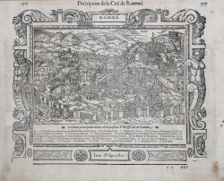
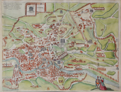
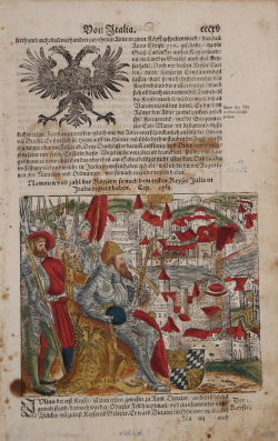
Antoine Du PINET
Code:
MS7454
Measures:
325 x 260 mm
Year:
1564
Printed:
Lyon
Ferrando BERTELLI
Code:
S39331
Measures:
245 x 180 mm
Year:
1568
Printed:
Venice
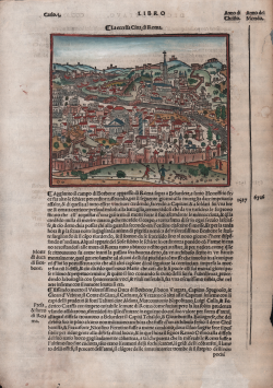
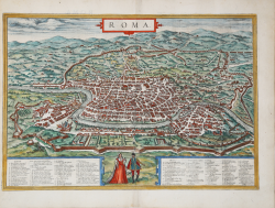
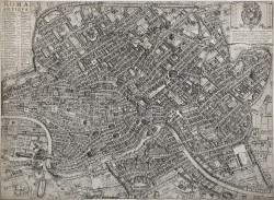
Georg BRAUN & Franz HOGENBERG
Code:
S49238.14
Measures:
485 x 335 mm
Year:
1572 ca.
Printed:
Antwerpen & Cologne
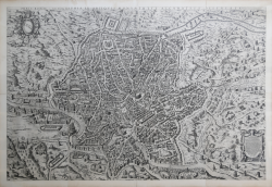
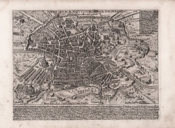
Etienne DUPERAC
Code:
S51905
Measures:
1540 x 1030 mm
Year:
1574 ca.
Printed:
Rome
Francois de BELLEFOREST
Code:
S48350
Measures:
435 x 340 mm
Year:
1575
Printed:
Paris
Georg BRAUN & Franz HOGENBERG
Code:
S49238.24
Measures:
502 x 385 mm
Year:
1575 ca.
Printed:
Antwerpen & Cologne
Ambrogio BRAMBILLA
Code:
S39442
Measures:
218 x 145 mm
Year:
1587
Printed:
Rome
Georg BRAUN & Franz HOGENBERG
Code:
S49238.8
Measures:
495 x 685 mm
Year:
1588
Printed:
Antwerpen & Cologne
Sebastian Münster
Code:
S38904
Measures:
205 x 320 mm
Year:
1588
Printed:
Basle
Sebastian Münster
Code:
S38903
Measures:
200 x 315 mm
Year:
1588
Printed:
Basle
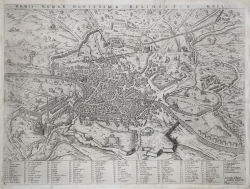
Giovanni Battista de’ CAVALIERI
Code:
S40344
Measures:
530 x 400 mm
Year:
1589
Printed:
Rome
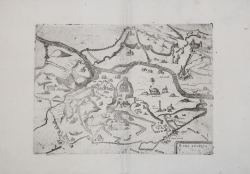
Giacomo LAURO
Code:
S46274
Measures:
240 x 180 mm
Year:
1618 ca.
Goert van SCHAYCK
Code:
S45002
Measures:
510 x 370 mm
Year:
1620 ca.
Printed:
Rome
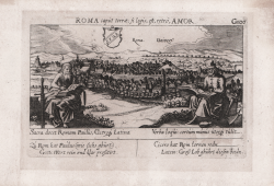
Daniel MEISNER
Code:
s23013
Measures:
150 x 100 mm
Year:
1623
Printed:
Nurnberg