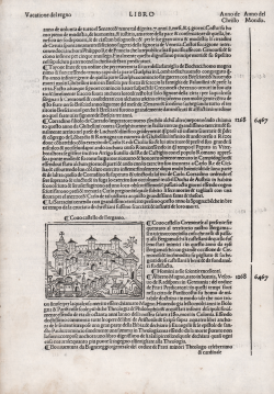
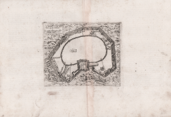
Covo Castello de Bergamo Giacomo Filippo FORESTI Code: CO-431 Measures: 160 x 255 mm Year: 1490 ca. Printed: Venice Price €150.00 Quick view View Details
Secutia Citta in Piemonte/Spoletto città in Umbria/ Crema Castello Giacomo Filippo FORESTI Code: CO-210 Measures: 200 x 290 mm Year: 1490 ca. Printed: Venice Price €250.00 Quick view View Details
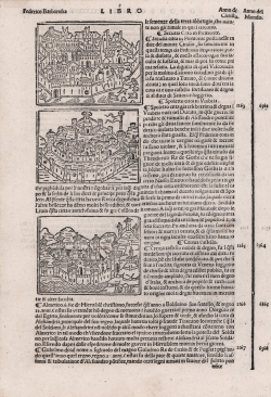
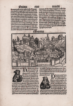
Mantua Hartmann SCHEDEL Code: MS5236 Measures: 225 x 195 mm Year: 1493 Printed: Nurnberg Price €400.00 Quick view View Details
Mantua Johann Schönsperger Code: S11889 Measures: 140 x 90 mm Year: 1496 Printed: Ausburg Price €400.00 Quick view View Details
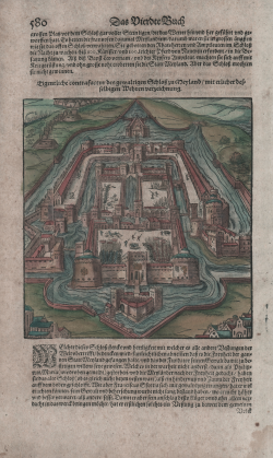
Eigentliche contrafactur des gewaltigen Schloss zu Meyland/mit... Sebastian Münster Code: S11369 Measures: 165 x 175 mm Year: 1550 ca. Printed: Basle Price €130.00 Quick view View Details
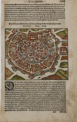
Der Statt Meyland… Sebastian Münster Code: S38937 Measures: 157 x 127 mm Year: 1550 ca. Printed: Basle Price €180.00 Quick view View Details
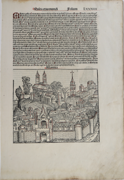
Pavia Sebastian Münster Code: S1389 Measures: 195 x 305 mm Year: 1550 ca. Printed: Basle Price €200.00 Quick view View Details
Pavie iadiz nommée Ticinum Sebastian Münster Code: S50049 Measures: 180 x 105 mm Year: 1552 Printed: Basle Price €225.00 Quick view View Details
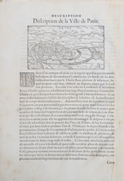
Description de la Ville de Pauie Guillaume GUEROULT Code: s22261 Measures: 124 x 700 mm Year: 1553 ca. Printed: Lyon Price €200.00 Quick view View Details
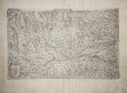
LOMBARDIA Vincenzo LUCHINI Code: S35104 Measures: 475 x 290 mm Year: 1556 ca. Printed: Rome Price €4,800.00 Quick view View Details
Il vero disegno della pianta di Milano sì come veramente ogi dì si... Paolo FORLANI Code: MS7271 Measures: 175 x 145 mm Year: 1567 ca. Printed: Venice Price €900.00 Quick view View Details
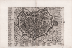
Milano Ferrando BERTELLI Code: S39323 Measures: 285 x 200 mm Year: 1568 ca. Printed: Venice Price €2,200.00 Quick view View Details
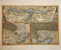
Larii Lacus vulgo Comensis & Territorii Romani descrip & Fori Iulii... Abraham ORTELIUS Code: MMS458 Measures: 496 x 350 mm Year: 1570 ca. Printed: Antwerpen Price €700.00 Quick view View Details
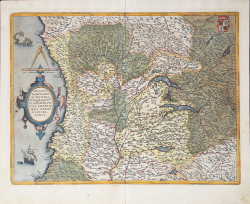
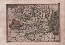
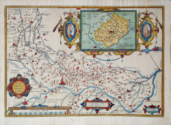
Ducatus mediolanensis, Finitimarumque Regionum Descriptio, Auctore... Abraham ORTELIUS Code: MMS454 Measures: 485 x 375 mm Year: 1570 ca. Printed: Antwerpen Price €750.00 Quick view View Details
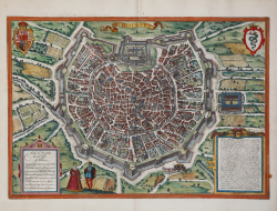
Mediolanum Georg BRAUN & Franz HOGENBERG Code: S49238.22 Measures: 480 x 335 mm Year: 1572 ca. Printed: Antwerpen & Cologne Price €1,600.00 Quick view View Details
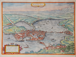
Mantua Georg BRAUN & Franz HOGENBERG Code: S49238.121 Measures: 500 x 360 mm Year: 1575 ca. Printed: Antwerpen & Cologne Price €750.00 Quick view View Details
Ducatus Mediolanensis finitimarumq(ue) regionis Abraham ORTELIUS - Philip GALLE Code: s33943 Measures: 107 x 80 mm Year: 1577 Printed: Antwerpen Price €150.00 Quick view View Details
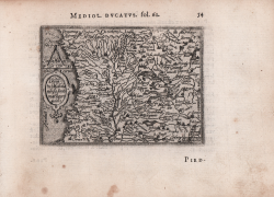
Mediolanensis Dvcatvs Jan MATAL [METELLUS] Code: s25015 Measures: 200 x 145 mm Year: 1579 ca. Printed: Cologne Price €1,200.00 Quick view View Details
Agri Cremonensis Typus Abraham ORTELIUS Code: S38298 Measures: 500 x 350 mm Year: 1579 ca. Printed: Antwerpen Price €600.00 Quick view View Details
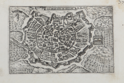
La gran cita di Milano Francesco VALEGIO Code: S9579 Measures: 125 x 80 mm Year: 1580 ca. Printed: Venice Price €300.00 Quick view View Details