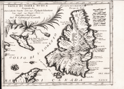
Isola di Terra Nuova Vincenzo CORONELLI Code: MS645 Measures: 310 x 235 mm Year: 1690 ca. Printed: Venice Price €225.00 Quick view View Details
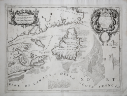
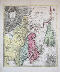
Canada Orientale nell'America Settentrionale... Vincenzo CORONELLI Code: S45270 Measures: 615 x 460 mm Year: 1690 ca. Printed: Venice Price €750.00 Quick view View Details
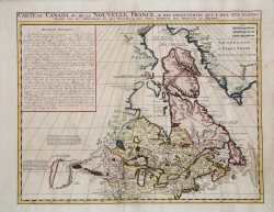
Carte du Canada ou de la Nouvelle France… Henri Abraham CHATELAIN Code: ms7206 Measures: 520 x 410 mm Year: 1708 ca. Printed: Amsterdam Price €850.00 Quick view View Details
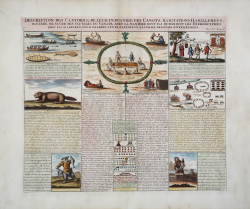
Description des Castors & de leur Industrie, des Canots,... Henri Abraham CHATELAIN Code: MS6590 Measures: 440 x 380 mm Year: 1708 ca. Printed: Amsterdam Price €375.00 Quick view View Details
Parte Orientale de la Nouvelle France ou de Canada…. Matthaus SEUTTER "il vecchio" Code: mms2021 Measures: 505 x 580 mm Year: 1745 ca. Printed: Augsburg Price €800.00 Quick view View Details
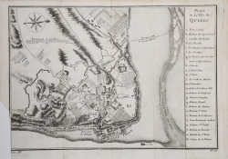
Plan de la Ville de Quebec Jacques Nicolas BELLIN Code: ms4388 Measures: 285 x 205 mm Year: 1757 ca. Printed: Paris Price €125.00 Quick view View Details
Carte des Parties du Nord-Ouest de l'Amerique Jacques Nicolas BELLIN Code: S32621 Measures: 275 x 225 mm Year: 1757 Printed: Paris Price €100.00 Quick view View Details
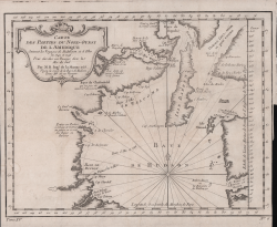
Carte de la Baye de Hudson Jacques Nicolas BELLIN Code: MS2987 Measures: 300 x 230 mm Year: 1757 Printed: Paris Price €130.00 Quick view View Details
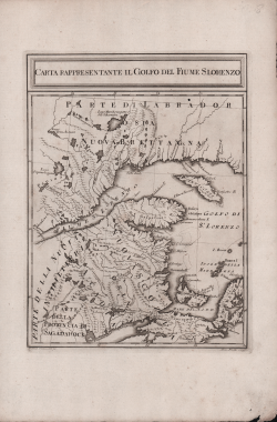
Carta Rappresentante il Golfo del Fiume S. Lorenzo Marco COLTELLINI Code: ms4778 Measures: 200 x 265 mm Year: 1777 ca. Printed: Leghorn Price €200.00 Quick view View Details
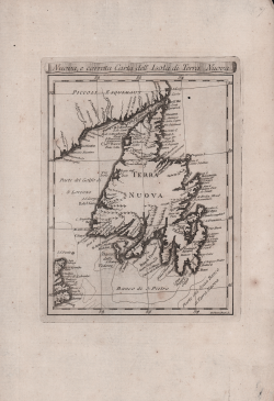
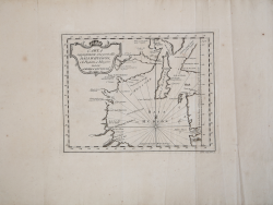
Nuova , e corretta Carta dell'Isola di Terra Nuova Marco COLTELLINI Code: ms4779 Measures: 175 x 230 mm Year: 1777 ca. Printed: Leghorn Price €125.00 Quick view View Details
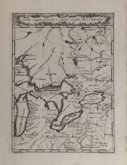
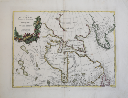
Carta rappresentante i cinque Laghi del Canada Marco COLTELLINI Code: MS4776 Measures: 195 x 260 mm Year: 1777 ca. Printed: Leghorn Price €350.00 Quick view View Details
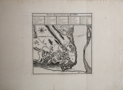
Piano della Città di Quebec Marco COLTELLINI Code: MS4777 Measures: 250 x 250 mm Year: 1777 ca. Printed: Leghorn Price €200.00 Quick view View Details
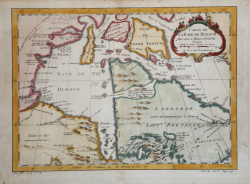
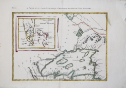
Carta rappresentante una parte d(e)lla Baya d'Hudson, e le Regioni... Marco COLTELLINI Code: MS4780 Measures: 280 x 220 mm Year: 1777 Printed: Leghorn Price €150.00 Quick view View Details
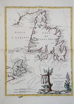
Le Isole di Terra Nuova e Capo Breton Antonio ZATTA Code: s10489 Measures: 330 x 440 mm Year: 1778 ca. Printed: Venice Price €300.00 Quick view View Details
La Baia d’Hudson Terra di Labrador e Groenlandia.. Antonio ZATTA Code: S4837 Measures: 440 x 330 mm Year: 1778 Printed: Venice Price €300.00 Quick view View Details
Il Paese de' Selvaggi Outauacesi, e Kilistinesi intorno al Lago... Antonio ZATTA Code: MS1778 Measures: 440 x 335 mm Year: 1778 Price €400.00 Quick view View Details
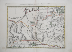
La Parte Occidentale della Nuova Francia o Canada Antonio ZATTA Code: MS6413 Measures: 440 x 335 mm Year: 1778 Price €325.00 Quick view View Details
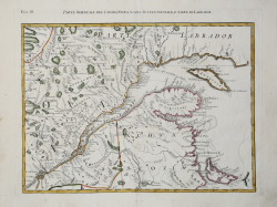
Parte Orientale del Canada, Nuova Scozia Settentrionale, e Parte di... Antonio ZATTA Code: MS6414 Measures: 445 x 335 mm Year: 1778 ca. Printed: Venice Price €350.00 Quick view View Details
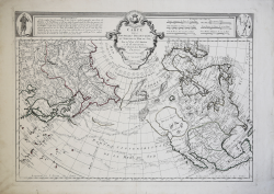
Carte des Nouvelles Decouvertes au Nord de la Mer du Sud Francesco & Paolo SANTINI Code: MS6043 Measures: 650 x 470 mm Year: 1780 Printed: Venice Price €900.00 Quick view View Details
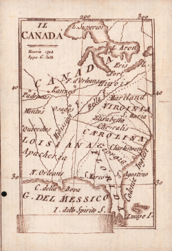
Il Canada Pietro Zancon Code: S40912 Measures: 70 x 100 mm Year: 1794 Printed: Venice Price €1,000.00 Quick view View Details