
| Reference: | S0083 |
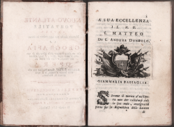
| Author | Giammaria Bassaglia |
| Year: | 1777 |
| Zone: | - |
| Measures: | 115 x 160 mm |
| Reference: | S0083 |
| Author | Giammaria Bassaglia |
| Year: | 1777 |
| Zone: | - |
| Measures: | 115 x 160 mm |
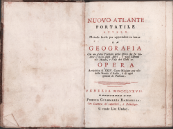
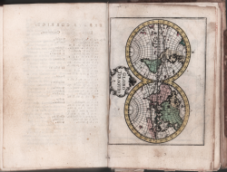
Nuovo Atlante Portatile ovvero Metodo facile per apprendere in breve la Geografia con un esatto trattato della Sfera che fa vedere il nome degli Astri, i vari Sistemi del Mondo, e l’uso dei Globi ec. Opera arricchita da XXIV carte miniate per so delle scuole d’Italia e di ogni genere di persone. // Venezia MDCCLXXVII presso Giammaria Bassaglia.
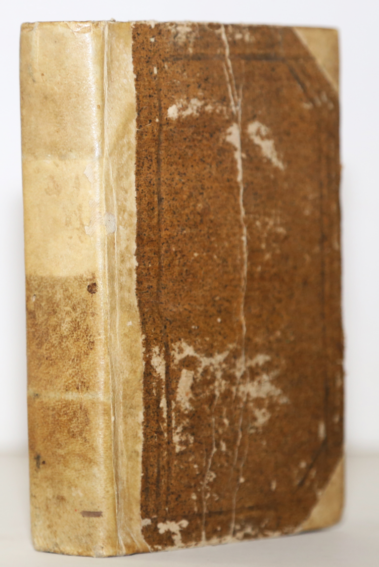
In 8°, XXVIII + 328 pp., [1] f. of Errata, 24 ff. of engraved plates, with fine original colouring.
Half vellum binding, embossed decorations to the covers, edges sprangled in red; a little worn, missing to the covers. Very good specimen, very rare foxing.
First edition with the date 1777, later reprinted in 1785.
As indicated by G. King this rare Atlas is an Italian pirated edition od the work by Christiaan Andreas Sepp, 1758.
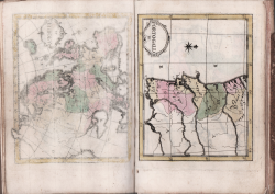
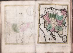
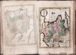
“Map engraver Christiaan Andreas Sepp, who died on 2nd August 1775, was the founder of a family business which became famous for its natural history plates. He was also the author of an innovative geographical textbook, for which he drew and engraved a uniform set of twenty-two miniature maps, about 120 x 95 mm. All the plates were beautifully engraved and although he only signed the first one, the world map, he made their authorship clear by signing it ‘C.Sepp omnes fecit’. Subsequently widely imitated by many other engravers, they were unusual in having no names of any kind. Instead, the titles were replaced by numbers I-XXII in cartouches and all the other names were represented by symbols, upper and lower case letters or arabic and roman figures. He produced a novel and entertaining method of teaching geography to children, by writing a chapter of questions and answers to go with the appropriate map. Each of these folded out in such a way as to be visible when the text
was read: I (The World); II (Europe); III (Portugal); IV (Spain); V (France); VI (Germany); VII (Switzerland); VIII (Italy); IX (Low Countries); X (Holland); XI (British Isles); XII (Denmark); XIII (Norway); XIV (Sweden); XV (Russia); XVI (Prussia); XVII (Poland); XVIII (Hungary); XIX (European Turkey); XX (Asia); XXI (Africa); XXII (America)”
(cfr. G. King, Miniature Antique Maps https://www.miniaturemaps.net/_webedit/uploaded-files/All%20Files/1701-1800/1758b%20Sepp.pdf
This Venetian school atlas/geography book includes an original color folding map of America showing California as a peninsula. The Americas are at Map XXII, with description of the discovery of America, climate, government ("al presente sono Provincie, che appartengono a diversi Sovrani Europei"), religion etc. With descriptions of territory held by New Spain, New Mexico ("Il Nuovo Messico, che comprenda la Penisola della California"), La Florida, La Virginia (in translation: which includes Georgia, Carolina, Virginia, Marieland (sic), La Pensilvania, La Nuova York, La Nuova Inghilterra, etc. No map of Australia, but Australia pre Cook delineated in the world map. Talks about the polar regions, again with no map.
Giammaria Bassaglia
Giammaria Bassaglia